Saint-Marcel night lights from space
Night Light of Saint-Marcel (Provence-Alpes-Côte d'Azur) from space (France) Src. Average luminocity for 10x10km area is 74.0409% and for 50x50km: 27.641%.
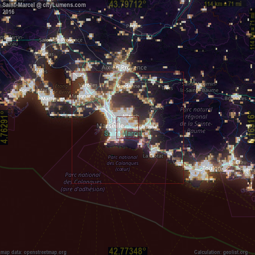
Analysis of Saint-Marcel night lights 2016
Square area 10x10 km:
 29.09%
90-99
23.94%80-89
4.55%70-79
3.03%60-69
5.91%50-59
6.06%40-49
3.03%30-39
11.82%20-29
11.67%10-19
0.91%0-9
0%Square area 50x50 km:
6.23%90-99
6.04%80-89
2.82%70-79
2.1%60-69
2.77%50-59
2.95%40-49
3.24%30-39
5.19%20-29
9.62%10-19
13.54%0-9
45.5%Clear (daylight) street map image can be seen on geolist.org.
Map coordinates:
43° 47' 49.6" North, 4° 45' 46.5" East
43° 17' 14.8" North, 5° 27' 57.7" East
42° 46' 24.5" North, 6° 10' 9" East
Some cities around Saint-Marcel sort by population:
• Marseille 12
2.6 km =1.6 mi,  291°
291°
• Marseille 11
2.3 km =1.4 mi,  279°
279°
• La Pomme
2 km =1.2 mi, 277°
• La Valbarelle
1 km =0.6 mi,  254°
254°
• Les Caillols
2.2 km =1.4 mi,  318°
318°
• La Fourragère
3.3 km =2.1 mi,  302°
302°
• La Penne-sur-Huveaune
4.1 km =2.5 mi,  98°
98°
• Les Trois-Lucs
2.9 km =1.8 mi,  354°
354°
2978595 (p: 10,256)
Sources (retrieved 2019-11-25):
» Earth at Night: Flat Maps 2012, 2016