Saint-Genest-Lerpt night lights from space
Night Light of Saint-Genest-Lerpt (Auvergne-Rhône-Alpes) from space (France) Src. Average luminocity for 10x10km area is 64.9349% and for 50x50km: 13.9385%.
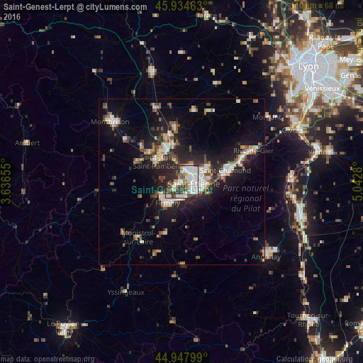
Analysis of Saint-Genest-Lerpt night lights 2016
Square area 10x10 km:
 20.95%
90-99
19.21%80-89
3.65%70-79
5.4%60-69
3.17%50-59
8.57%40-49
4.29%30-39
12.86%20-29
19.68%10-19
2.22%0-9
0%Square area 50x50 km:
2.12%90-99
2.63%80-89
1.14%70-79
1.16%60-69
1.68%50-59
1.73%40-49
2.08%30-39
1.86%20-29
4.79%10-19
10.03%0-9
70.78%Clear (daylight) street map image can be seen on geolist.org.
Map coordinates:
45° 56' 4.7" North, 3° 38' 11.6" East
45° 26' 36.5" North, 4° 20' 22.8" East
44° 56' 52.8" North, 5° 2' 34.1" East
Some cities around Saint-Genest-Lerpt sort by population:
• Firminy
7.2 km =4.5 mi,  213°
213°
• Le Chambon-Feugerolles
6 km =3.7 mi,  193°
193°
• Roche-la-Molière
1.7 km =1.1 mi, 212°
• Villars
3 km =1.9 mi,  24°
24°
• Unieux
6.9 km =4.3 mi,  230°
230°
• La Ricamarie
4.8 km =3 mi,  151°
151°
• Sorbiers
9.6 km =6 mi,  56°
56°
• La Talaudière
7.6 km =4.7 mi, 61°
2980012 (p: 5,792)
Sources (retrieved 2019-11-25):
» Earth at Night: Flat Maps 2012, 2016