Saint-Florent-sur-Cher night lights from space
Night Light of Saint-Florent-sur-Cher (Centre) from space (France) Src. Average luminocity for 10x10km area is 12.169% and for 50x50km: 7.0632%.
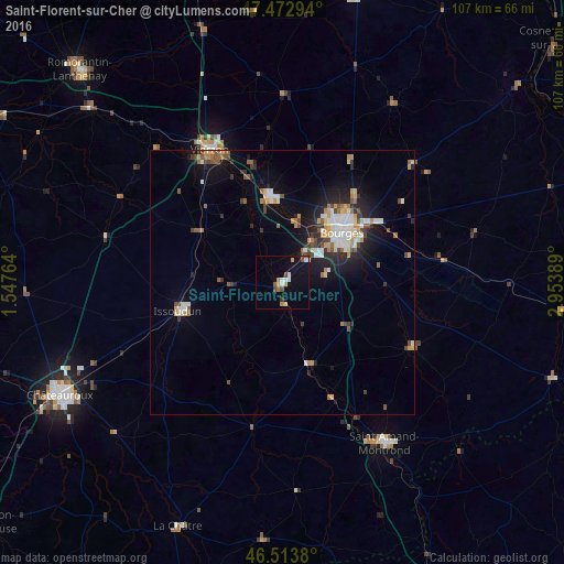
Analysis of Saint-Florent-sur-Cher night lights 2016
Square area 10x10 km:
 1.42%
1.42%90-99
2.27%80-89
1.14%70-79
1.7%60-69
1.14%50-59
1.28%40-49
1.85%30-39
0.99%20-29
0.14%10-19
6.68%0-9
81.39%Square area 50x50 km:
0.96%90-99
1.31%80-89
0.7%70-79
0.92%60-69
0.69%50-59
0.87%40-49
1.01%30-39
0.71%20-29
1.89%10-19
4.38%0-9
86.54%Clear (daylight) street map image can be seen on geolist.org.
Map coordinates:
47° 28' 22.6" North, 1° 32' 51.5" East
46° 59' 43.9" North, 2° 15' 2.7" East
46° 30' 49.7" North, 2° 57' 14" East
Some cities around Saint-Florent-sur-Cher sort by population:
• Bourges
14.9 km =9.3 mi,  49°
49°
• Châteauroux
47 km =29.2 mi,  244°
244°
• Vierzon
28.7 km =17.8 mi,  331°
331°
• Issoudun
20.2 km =12.6 mi,  254°
254°
• Déols
45.4 km =28.2 mi, 246°
• Mehun-sur-Yèvre
16.1 km =10 mi,  349°
349°
• Salbris
50 km =31.1 mi,  342°
342°
• Le Poinçonnet
48 km =29.8 mi, 237°
2980107 (p: 7,083)
Sources (retrieved 2019-11-25):
» Earth at Night: Flat Maps 2012, 2016