Saint-Cyprien-Plage night lights from space
Night Light of Saint-Cyprien-Plage (Occitanie) from space (France) Src. Average luminocity for 10x10km area is 30.0818% and for 50x50km: 14.7351%.
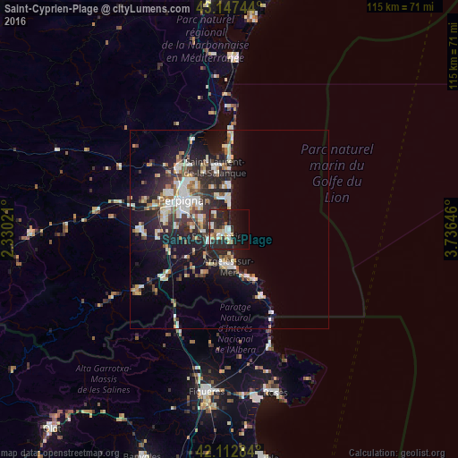
Analysis of Saint-Cyprien-Plage night lights 2016
Square area 10x10 km:
 5.61%
5.61%90-99
5.3%80-89
4.09%70-79
2.88%60-69
0.91%50-59
3.33%40-49
0.61%30-39
3.79%20-29
24.39%10-19
21.21%0-9
27.88%Square area 50x50 km:
2.33%90-99
3.06%80-89
1.62%70-79
1.17%60-69
1.61%50-59
1.5%40-49
1.42%30-39
2.21%20-29
5.99%10-19
10.77%0-9
68.32%Clear (daylight) street map image can be seen on geolist.org.
Map coordinates:
43° 8' 50.8" North, 2° 19' 48.8" East
42° 37' 56.2" North, 3° 1' 60" East
42° 6' 46.2" North, 3° 44' 11.3" East
Some cities around Saint-Cyprien-Plage sort by population:
• Perpignan
13.4 km =8.3 mi,  302°
302°
• Canet-en-Roussillon
7.7 km =4.8 mi,  349°
349°
• Argeles
9.5 km =5.9 mi,  185°
185°
• Cabestany
9.3 km =5.8 mi,  305°
305°
• Bompas
13.9 km =8.6 mi,  323°
323°
• Elne
6.2 km =3.9 mi,  234°
234°
• Toulouges
17.1 km =10.6 mi,  284°
284°
• Pia
15.6 km =9.7 mi, 323°
2980976 (p: 9,369)
Sources (retrieved 2019-11-25):
» Earth at Night: Flat Maps 2012, 2016