Canet-en-Roussillon night lights from space
Night Light of Canet-en-Roussillon (Occitanie) from space (France) Src. Average luminocity for 10x10km area is 29.9621% and for 50x50km: 14.6524%.
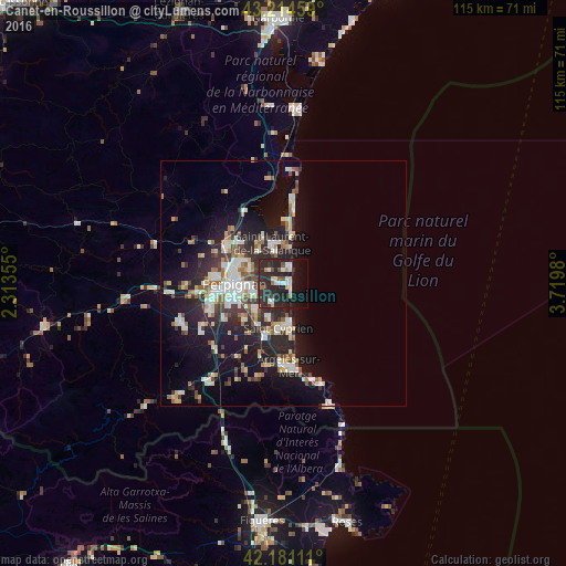
Analysis of Canet-en-Roussillon night lights 2016
Square area 10x10 km:
 4.39%
4.39%90-99
5.91%80-89
1.21%70-79
2.88%60-69
1.36%50-59
1.67%40-49
2.27%30-39
5%20-29
34.24%10-19
21.97%0-9
19.09%Square area 50x50 km:
2.21%90-99
3.03%80-89
1.67%70-79
1.17%60-69
1.56%50-59
1.55%40-49
1.48%30-39
2.2%20-29
5.93%10-19
10.72%0-9
68.49%Clear (daylight) street map image can be seen on geolist.org.
Map coordinates:
43° 12' 52.5" North, 2° 18' 48.8" East
42° 42' 0" North, 3° 1' 0" East
42° 10' 52" North, 3° 43' 11.3" East
Some cities around Canet-en-Roussillon sort by population:
• Perpignan
9.9 km =6.2 mi,  268°
268°
• Saint-Estève
14.1 km =8.8 mi,  275°
275°
• Saint-Cyprien-Plage
7.7 km =4.8 mi,  169°
169°
• Cabestany
6.5 km =4 mi,  251°
251°
• Saint-Laurent-de-la-Salanque
8.4 km =5.2 mi,  344°
344°
• Bompas
7.8 km =4.8 mi,  298°
298°
• Elne
11.7 km =7.3 mi,  198°
198°
• Pia
9.4 km =5.8 mi, 302°
3028832 (p: 11,148)
Sources (retrieved 2019-11-25):
» Earth at Night: Flat Maps 2012, 2016