Sablé-sur-Sarthe night lights from space
Night Light of Sablé-sur-Sarthe (Pays de la Loire) from space (France) Src. Average luminocity for 10x10km area is 9.3795% and for 50x50km: 0.8152%.
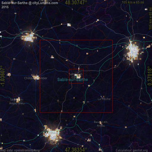
Analysis of Sablé-sur-Sarthe night lights 2016
Square area 10x10 km:
 1.19%
1.19%90-99
1.19%80-89
1.64%70-79
0.89%60-69
2.83%50-59
0.6%40-49
0.3%30-39
0.89%20-29
0.3%10-19
1.04%0-9
89.14%Square area 50x50 km:
0.07%90-99
0.07%80-89
0.11%70-79
0.08%60-69
0.17%50-59
0.15%40-49
0.12%30-39
0.18%20-29
0.1%10-19
0.16%0-9
98.78%Clear (daylight) street map image can be seen on geolist.org.
Map coordinates:
48° 18' 26.9" North, 1° 2' 9.9" West
47° 50' 15.5" North, 0° 19' 58.6" West
47° 21' 48.7" North, 0° 22' 12.6" East
Some cities around Sablé-sur-Sarthe sort by population:
• Laval
41.4 km =25.7 mi,  309°
309°
• La Flèche
24.7 km =15.3 mi,  128°
128°
• Château-Gontier
27.6 km =17.1 mi,  267°
267°
• Allonnes
39.3 km =24.4 mi,  68°
68°
• Évron
35.8 km =22.2 mi,  352°
352°
• Juigné
14 km =8.7 mi,  199°
199°
• Arnage
40.1 km =24.9 mi,  75°
75°
• Bonchamp-lès-Laval
37.9 km =23.5 mi, 313°
2982076 (p: 14,734)
Sources (retrieved 2019-11-25):
» Earth at Night: Flat Maps 2012, 2016