Reignier-Ésery night lights from space
Night Light of Reignier-Ésery (Auvergne-Rhône-Alpes) from space (France) Src. Average luminocity for 10x10km area is 20.1861% and for 50x50km: 19.4854%.
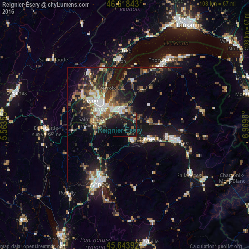
Analysis of Reignier-Ésery night lights 2016
Square area 10x10 km:
 0.14%
0.14%90-99
1.85%80-89
0.57%70-79
0.28%60-69
1.99%50-59
4.69%40-49
5.26%30-39
5.68%20-29
13.49%10-19
37.36%0-9
28.69%Square area 50x50 km:
2.68%90-99
3.5%80-89
1.41%70-79
1.61%60-69
2.34%50-59
2.78%40-49
3.66%30-39
3.72%20-29
5.59%10-19
18.01%0-9
54.71%Clear (daylight) street map image can be seen on geolist.org.
Map coordinates:
46° 37' 6.3" North, 5° 33' 48.8" East
46° 7' 60" North, 6° 16' 0" East
45° 38' 38.1" North, 6° 58' 11.3" East
Some cities around Reignier-Ésery sort by population:
• Annemasse
7.1 km =4.4 mi,  341°
341°
• Thônex, CH
8 km =5 mi,  319°
319°
• Gaillard
7.4 km =4.6 mi, 321°
• La Roche-sur-Foron
7.5 km =4.7 mi,  157°
157°
• Veyrier, CH
7.4 km =4.6 mi,  300°
300°
• Chêne-Bourg, CH
8.9 km =5.5 mi, 320°
• Ville-la-Grand
7.9 km =4.9 mi,  350°
350°
• Vétraz-Monthoux
4.6 km =2.9 mi, 352°
2984127 (p: 5,892)
Sources (retrieved 2019-11-25):
» Earth at Night: Flat Maps 2012, 2016