Nueil-les-Aubiers night lights from space
Night Light of Nueil-les-Aubiers (Nouvelle-Aquitaine) from space (France) Src. Average luminocity for 10x10km area is 1.4688% and for 50x50km: 2.6225%.
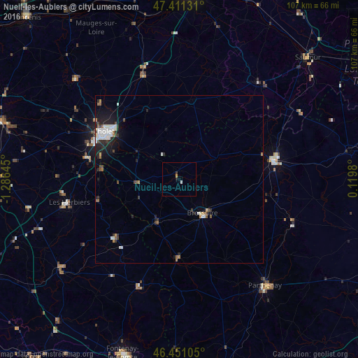
Analysis of Nueil-les-Aubiers night lights 2016
Square area 10x10 km:
 0%
0%90-99
0.57%80-89
0%70-79
0.57%60-69
0%50-59
0%40-49
0.14%30-39
0.43%20-29
0.57%10-19
0%0-9
97.73%Square area 50x50 km:
0.55%90-99
0.57%80-89
0.1%70-79
0.16%60-69
0.28%50-59
0.28%40-49
0.28%30-39
0.38%20-29
0.9%10-19
1.63%0-9
94.87%Clear (daylight) street map image can be seen on geolist.org.
Map coordinates:
47° 24' 40.7" North, 1° 17' 11.2" West
46° 55' 60" North, 0° 34' 60" West
46° 27' 3.8" North, 0° 7' 11.3" East
Some cities around Nueil-les-Aubiers sort by population:
• Cholet
26.5 km =16.5 mi,  301°
301°
• Bressuire
12.4 km =7.7 mi,  145°
145°
• Les Herbiers
33.7 km =20.9 mi,  257°
257°
• Thouars
28.7 km =17.8 mi,  79°
79°
• Doué-la-Fontaine
37.2 km =23.1 mi,  38°
38°
• Chemillé-Melay
33.1 km =20.6 mi,  341°
341°
• Mortagne-sur-Sèvre
28.4 km =17.6 mi,  283°
283°
• Pouzauges
25.7 km =16 mi,  228°
228°
2989852 (p: 5,195)
Sources (retrieved 2019-11-25):
» Earth at Night: Flat Maps 2012, 2016