Les Angles night lights from space
Night Light of Les Angles (Occitanie) from space (France) Src. Average luminocity for 10x10km area is 46.0492% and for 50x50km: 23.5606%.
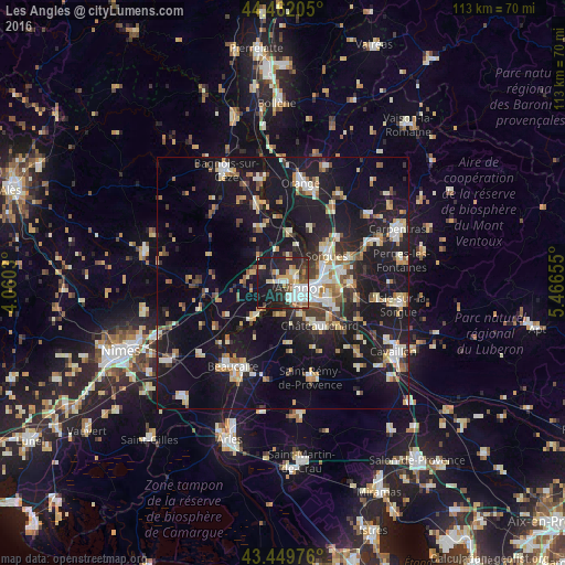
Analysis of Les Angles night lights 2016
Square area 10x10 km:
 10.48%
90-99
8.73%80-89
5.56%70-79
6.03%60-69
4.44%50-59
4.6%40-49
3.17%30-39
4.6%20-29
21.11%10-19
30.48%0-9
0.79%Square area 50x50 km:
2.87%90-99
4.22%80-89
2.73%70-79
2.57%60-69
2.81%50-59
2.3%40-49
2.77%30-39
2.56%20-29
5.95%10-19
29.95%0-9
41.27%Clear (daylight) street map image can be seen on geolist.org.
Map coordinates:
44° 27' 43.4" North, 4° 3' 37.1" East
43° 57' 29" North, 4° 45' 48.3" East
43° 26' 59.1" North, 5° 27' 59.6" East
Some cities around Les Angles sort by population:
• Avignon
3.8 km =2.4 mi,  106°
106°
• Sorgues
10.6 km =6.6 mi,  56°
56°
• Le Pontet
7.7 km =4.8 mi,  87°
87°
• Montfavet
9.2 km =5.7 mi, 107°
• Villeneuve-lès-Avignon
2.9 km =1.8 mi,  66°
66°
• Morières-lès-Avignon
11.2 km =7 mi,  100°
100°
• Rochefort-du-Gard
6.2 km =3.9 mi,  289°
289°
• Roquemaure
10.2 km =6.3 mi,  6°
6°
3002158 (p: 8,318)
Sources (retrieved 2019-11-25):
» Earth at Night: Flat Maps 2012, 2016