Le Blanc night lights from space
Night Light of Le Blanc (Centre) from space (France) Src. Average luminocity for 10x10km area is 0.6946% and for 50x50km: 0.1006%.
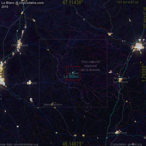
Analysis of Le Blanc night lights 2016
Square area 10x10 km:
 0%
0%90-99
0%80-89
0%70-79
0%60-69
0%50-59
0%40-49
0.57%30-39
0%20-29
1.56%10-19
0.14%0-9
97.73%Square area 50x50 km:
0%90-99
0%80-89
0%70-79
0%60-69
0%50-59
0%40-49
0.08%30-39
0.04%20-29
0.13%10-19
0.08%0-9
99.67%Clear (daylight) street map image can be seen on geolist.org.
Map coordinates:
47° 6' 51.7" North, 0° 21' 34.6" East
46° 38' 1.4" North, 1° 3' 45.8" East
46° 8' 55.5" North, 1° 45' 57.1" East
Some cities around Le Blanc sort by population:
• Châteauroux
52 km =32.3 mi,  67°
67°
• Châtellerault
44.4 km =27.6 mi,  297°
297°
• Buxerolles
44.3 km =27.5 mi,  267°
267°
• Montmorillon
27.4 km =17 mi,  212°
212°
• Chauvigny
32.8 km =20.4 mi,  257°
257°
• Naintré
46.5 km =28.9 mi,  287°
287°
• Argenton-sur-Creuse
35.2 km =21.9 mi,  97°
97°
• Le Poinçonnet
52 km =32.3 mi, 73°
3005270 (p: 7,026)
Sources (retrieved 2019-11-25):
» Earth at Night: Flat Maps 2012, 2016