Guer night lights from space
Night Light of Guer (Brittany) from space (France) Src. Average luminocity for 10x10km area is 1.6591% and for 50x50km: 0.9861%.
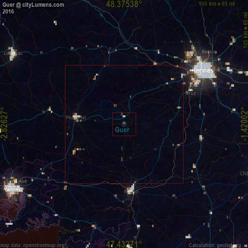
Analysis of Guer night lights 2016
Square area 10x10 km:
 0%
0%90-99
0.57%80-89
0.57%70-79
0%60-69
0%50-59
0%40-49
0%30-39
0.71%20-29
0.99%10-19
0%0-9
97.16%Square area 50x50 km:
0.05%90-99
0.13%80-89
0.11%70-79
0.09%60-69
0.17%50-59
0.13%40-49
0.19%30-39
0.34%20-29
0.19%10-19
0.21%0-9
98.41%Clear (daylight) street map image can be seen on geolist.org.
Map coordinates:
48° 22' 31.4" North, 2° 49' 34.6" West
47° 54' 22.3" North, 2° 7' 23.3" West
47° 25' 57.8" North, 1° 25' 12.1" West
Some cities around Guer sort by population:
• Bruz
31 km =19.3 mi,  64°
64°
• Redon
28.5 km =17.7 mi,  174°
174°
• Ploërmel
20.7 km =12.9 mi,  277°
277°
• Guichen
25.4 km =15.8 mi,  74°
74°
• Le Rheu
32.6 km =20.3 mi,  48°
48°
• Mordelles
28.1 km =17.5 mi, 47°
• Bain-de-Bretagne
33.4 km =20.8 mi,  101°
101°
• Montfort-sur-Meu
28.5 km =17.7 mi,  26°
26°
3014393 (p: 6,308)
Sources (retrieved 2019-11-25):
» Earth at Night: Flat Maps 2012, 2016