Guichen night lights from space
Night Light of Guichen (Brittany) from space (France) Src. Average luminocity for 10x10km area is 1.3537% and for 50x50km: 5.7895%.
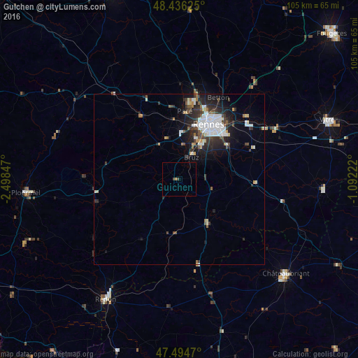
Analysis of Guichen night lights 2016
Square area 10x10 km:
 0%
0%90-99
0%80-89
0%70-79
0.57%60-69
0%50-59
0%40-49
1.14%30-39
0%20-29
0%10-19
0%0-9
98.3%Square area 50x50 km:
1.54%90-99
1%80-89
0.43%70-79
0.3%60-69
0.39%50-59
0.58%40-49
0.75%30-39
1.1%20-29
2.05%10-19
3.35%0-9
88.51%Clear (daylight) street map image can be seen on geolist.org.
Map coordinates:
48° 26' 10.5" North, 2° 29' 54.5" West
47° 58' 3.4" North, 1° 47' 43.2" West
47° 29' 40.9" North, 1° 5' 32" West
Some cities around Guichen sort by population:
• Bruz
7.3 km =4.5 mi,  30°
30°
• Saint-Jacques-de-la-Lande
12.2 km =7.6 mi, 27°
• Vern-sur-Seiche
16.9 km =10.5 mi,  59°
59°
• Chartres-de-Bretagne
10.4 km =6.5 mi,  40°
40°
• Le Rheu
15 km =9.3 mi,  359°
359°
• Mordelles
12.5 km =7.8 mi,  343°
343°
• Châtillon-sur-Seiche
11.9 km =7.4 mi,  51°
51°
• Bain-de-Bretagne
16 km =9.9 mi,  149°
149°
3014305 (p: 7,142)
Sources (retrieved 2019-11-25):
» Earth at Night: Flat Maps 2012, 2016