Montfort-sur-Meu night lights from space
Night Light of Montfort-sur-Meu (Brittany) from space (France) Src. Average luminocity for 10x10km area is 1.7158% and for 50x50km: 5.0196%.
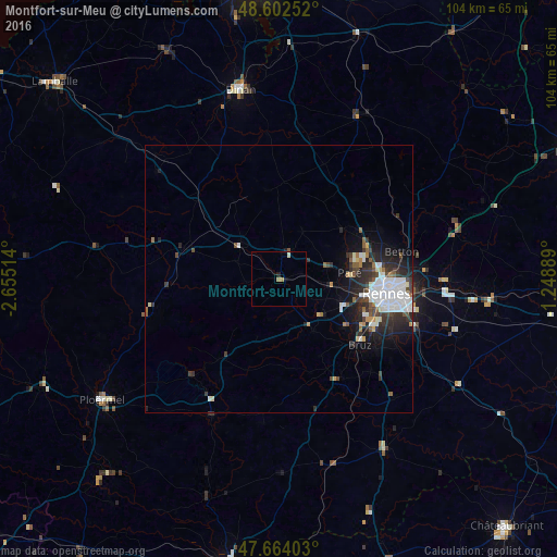
Analysis of Montfort-sur-Meu night lights 2016
Square area 10x10 km:
 0%
0%90-99
0.3%80-89
0.3%70-79
0%60-69
1.19%50-59
0%40-49
0%30-39
0%20-29
0%10-19
0.6%0-9
97.62%Square area 50x50 km:
1.47%90-99
0.85%80-89
0.31%70-79
0.22%60-69
0.38%50-59
0.58%40-49
0.62%30-39
1.02%20-29
1.9%10-19
2.56%0-9
90.1%Clear (daylight) street map image can be seen on geolist.org.
Map coordinates:
48° 36' 9.1" North, 2° 39' 18.5" West
48° 8' 7.5" North, 1° 57' 7.2" West
47° 39' 50.5" North, 1° 14' 56" West
Some cities around Montfort-sur-Meu sort by population:
• Rennes
20.8 km =12.9 mi,  97°
97°
• Bruz
19.7 km =12.2 mi,  128°
128°
• Pacé
13.3 km =8.3 mi,  83°
83°
• Saint-Jacques-de-la-Lande
18.9 km =11.7 mi,  114°
114°
• Saint-Grégoire
19.7 km =12.2 mi,  85°
85°
• Le Rheu
12.1 km =7.5 mi, 107°
• Mordelles
10.5 km =6.5 mi, 129°
• Melesse
21.1 km =13.1 mi,  64°
64°
2992581 (p: 6,007)
Sources (retrieved 2019-11-25):
» Earth at Night: Flat Maps 2012, 2016