Domène night lights from space
Night Light of Domène (Auvergne-Rhône-Alpes) from space (France) Src. Average luminocity for 10x10km area is 34.9015% and for 50x50km: 11.5247%.
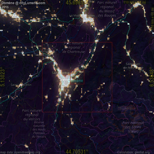
Analysis of Domène night lights 2016
Square area 10x10 km:
 3.94%
3.94%90-99
5.45%80-89
4.7%70-79
3.33%60-69
4.55%50-59
8.18%40-49
5.45%30-39
5.76%20-29
15.3%10-19
19.85%0-9
23.48%Square area 50x50 km:
2.09%90-99
1.97%80-89
0.93%70-79
1.05%60-69
1.02%50-59
1.7%40-49
1.39%30-39
2.31%20-29
3.52%10-19
8.43%0-9
75.6%Clear (daylight) street map image can be seen on geolist.org.
Map coordinates:
45° 41' 46.1" North, 5° 7' 48.8" East
45° 12' 10.4" North, 5° 50' 0.1" East
44° 42' 19.1" North, 6° 32' 11.3" East
Some cities around Domène sort by population:
• Saint-Martin-d’Hères
6.1 km =3.8 mi,  244°
244°
• Meylan
4.4 km =2.7 mi,  279°
279°
• Eybens
9 km =5.6 mi,  226°
226°
• Crolles
9 km =5.6 mi,  23°
23°
• Villard-Bonnot
5.3 km =3.3 mi,  47°
47°
• La Tronche
6.8 km =4.2 mi,  272°
272°
• Saint-Ismier
5.5 km =3.4 mi,  357°
357°
• Gières
4.3 km =2.7 mi, 233°
3021210 (p: 6,882)
Sources (retrieved 2019-11-25):
» Earth at Night: Flat Maps 2012, 2016