Dol-de-Bretagne night lights from space
Night Light of Dol-de-Bretagne (Brittany) from space (France) Src. Average luminocity for 10x10km area is 1.0506% and for 50x50km: 2.9065%.
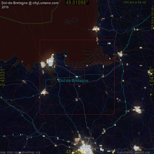
Analysis of Dol-de-Bretagne night lights 2016
Square area 10x10 km:
 0.6%
0.6%90-99
0%80-89
0%70-79
0%60-69
0%50-59
0.3%40-49
0.3%30-39
0%20-29
0%10-19
0%0-9
98.81%Square area 50x50 km:
0.59%90-99
0.76%80-89
0.14%70-79
0.2%60-69
0.18%50-59
0.18%40-49
0.3%30-39
0.38%20-29
0.82%10-19
2.3%0-9
94.16%Clear (daylight) street map image can be seen on geolist.org.
Map coordinates:
49° 0' 39.5" North, 2° 27' 11.9" West
48° 32' 51.5" North, 1° 45' 0.6" West
48° 4' 48.1" North, 1° 2' 49.4" West
Some cities around Dol-de-Bretagne sort by population:
• Saint-Malo
22 km =13.7 mi,  300°
300°
• Granville
34.2 km =21.3 mi,  19°
19°
• Dinan
24.4 km =15.2 mi,  245°
245°
• Dinard
24.7 km =15.3 mi,  292°
292°
• Avranches
32.7 km =20.3 mi,  62°
62°
• Cancale
16.1 km =10 mi,  332°
332°
• Melesse
36.9 km =22.9 mi,  173°
173°
• Combourg
15 km =9.3 mi,  178°
178°
3021264 (p: 5,394)
Sources (retrieved 2019-11-25):
» Earth at Night: Flat Maps 2012, 2016