Cestas night lights from space
Night Light of Cestas (Nouvelle-Aquitaine) from space (France) Src. Average luminocity for 10x10km area is 39.4061% and for 50x50km: 23.8743%.
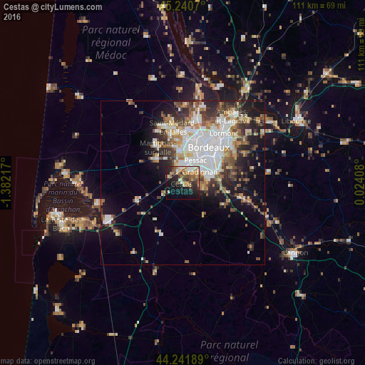
Analysis of Cestas night lights 2016
Square area 10x10 km:
 3.48%
3.48%90-99
5.3%80-89
5.91%70-79
8.18%60-69
6.67%50-59
6.21%40-49
6.52%30-39
4.55%20-29
12.73%10-19
23.79%0-9
16.67%Square area 50x50 km:
5.86%90-99
4.63%80-89
2.44%70-79
2.33%60-69
3%50-59
2.98%40-49
3.11%30-39
3.59%20-29
5.24%10-19
9.28%0-9
57.54%Clear (daylight) street map image can be seen on geolist.org.
Map coordinates:
45° 14' 26.5" North, 1° 22' 55.8" West
44° 44' 36.4" North, 0° 40' 44.6" West
44° 14' 30.8" North, 0° 1' 26.7" East
Some cities around Cestas sort by population:
• Mérignac
10.5 km =6.5 mi,  19°
19°
• Pessac
8 km =5 mi, 21°
• Talence
9.5 km =5.9 mi,  44°
44°
• Villenave-d’Ornon
11.2 km =7 mi,  72°
72°
• Gradignan
6.1 km =3.8 mi,  57°
57°
• Léognan
6.5 km =4 mi,  97°
97°
• Saint-Jean-d’Illac
11.1 km =6.9 mi,  310°
310°
• Canéjan
4.4 km =2.7 mi,  54°
54°
3027763 (p: 18,036)
Sources (retrieved 2019-11-25):
» Earth at Night: Flat Maps 2012, 2016