Carpentras night lights from space
Night Light of Carpentras (Provence-Alpes-Côte d'Azur) from space (France) Src. Average luminocity for 10x10km area is 34.5143% and for 50x50km: 17.7727%.
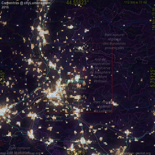
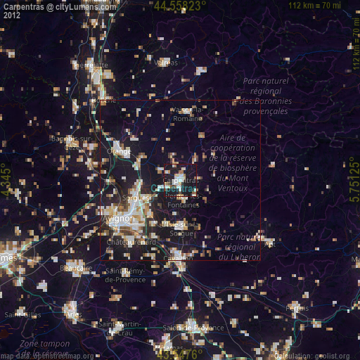
Analysis of Carpentras night lights 2016
Square area 10x10 km:
 5.87%
5.87%90-99
6.19%80-89
3.17%70-79
5.08%60-69
4.13%50-59
1.9%40-49
2.22%30-39
0.95%20-29
15.56%10-19
50.79%0-9
4.13%Square area 50x50 km:
2.26%90-99
3.27%80-89
2.1%70-79
1.99%60-69
2.16%50-59
1.99%40-49
1.76%30-39
2.31%20-29
4.87%10-19
19.83%0-9
57.47%Clear (daylight) street map image can be seen on geolist.org.
Map coordinates:
44° 33' 29.6" North, 4° 20' 42" East
44° 3' 18.3" North, 5° 2' 53.3" East
43° 32' 51.4" North, 5° 45' 4.5" East
Some cities around Carpentras sort by population:
• Pernes-les-Fontaines
6.4 km =4 mi,  172°
172°
• Monteux
4.6 km =2.9 mi,  243°
243°
• Vedène
14.4 km =8.9 mi,  233°
233°
• Entraigues-sur-la-Sorgue
11.3 km =7 mi, 239°
• Sarrians
6.9 km =4.3 mi,  296°
296°
• Courthézon
13.6 km =8.5 mi,  285°
285°
• Mazan
6.3 km =3.9 mi,  88°
88°
• Bédarrides
12.1 km =7.5 mi,  262°
262°
3028542 (p: 29,709)
Sources (retrieved 2019-11-25):
» Earth at Night: Flat Maps 2012, 2016