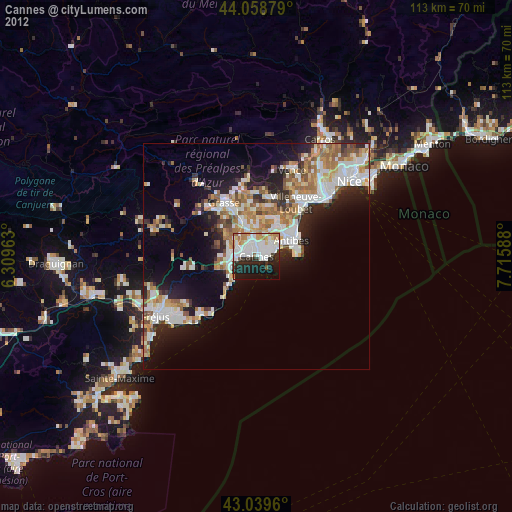
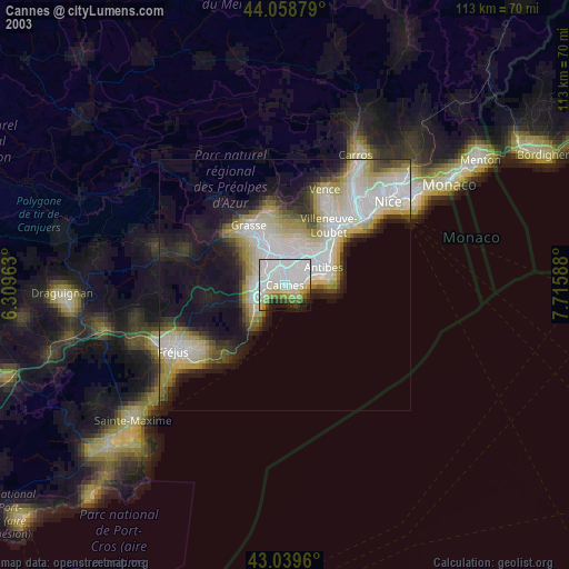
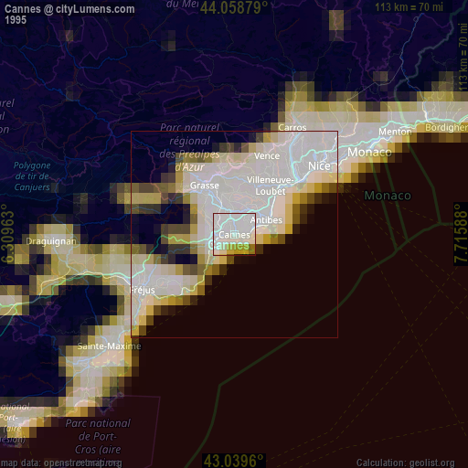
Cannes night lights from space
Night Light of Cannes (Provence-Alpes-Côte d'Azur) from space (France) Src. Average luminocity for 10x10km area is 61.4079% and for 50x50km: 22.9829%.
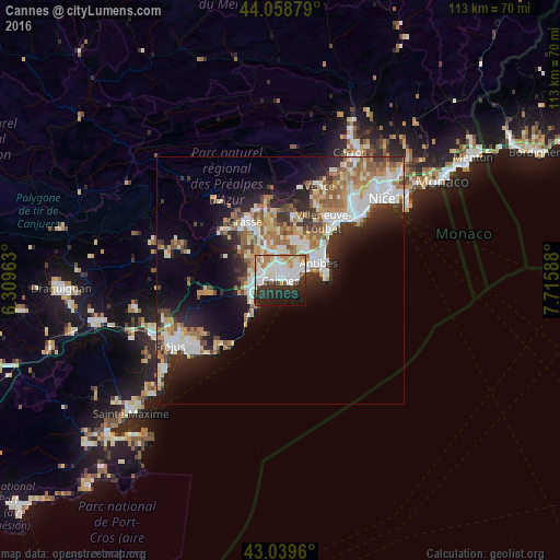
Analysis of Cannes night lights 2016
Square area 10x10 km:
 20.95%
90-99
18.25%80-89
4.29%70-79
4.76%60-69
6.03%50-59
2.38%40-49
1.59%30-39
10%20-29
17.62%10-19
12.38%0-9
1.75%Square area 50x50 km:
4.41%90-99
5.35%80-89
2.29%70-79
2.4%60-69
3.52%50-59
3.22%40-49
2.26%30-39
3.06%20-29
5.8%10-19
9.24%0-9
58.45%Clear (daylight) street map image can be seen on geolist.org.
Map coordinates:
44° 3' 31.6" North, 6° 18' 34.7" East
43° 33' 4.9" North, 7° 0' 45.9" East
43° 2' 22.6" North, 7° 42' 57.2" East
Some cities around Cannes sort by population:
• Antibes
8.6 km =5.3 mi,  63°
63°
• Le Cannet
2.9 km =1.8 mi,  10°
10°
• Vallauris
4.5 km =2.8 mi,  48°
48°
• Mandelieu-la-Napoule
6.1 km =3.8 mi,  264°
264°
• Mougins
5.7 km =3.5 mi,  345°
345°
• Valbonne
9.1 km =5.7 mi, 353°
• Mouans-Sartoux
8.4 km =5.2 mi,  336°
336°
• Pégomas
8.2 km =5.1 mi,  307°
307°
3028808 (p: 70,011)
Sources (retrieved 2019-11-25):
» NASA, Earths city lights 1995
» NASA city lights 2003
» Earth at Night: Flat Maps 2012, 2016