Antibes night lights from space
Night Light of Antibes (Provence-Alpes-CĂ´te d'Azur) from space (France) Src. Average luminocity for 10x10km area is 59.653% and for 50x50km: 22.7704%.
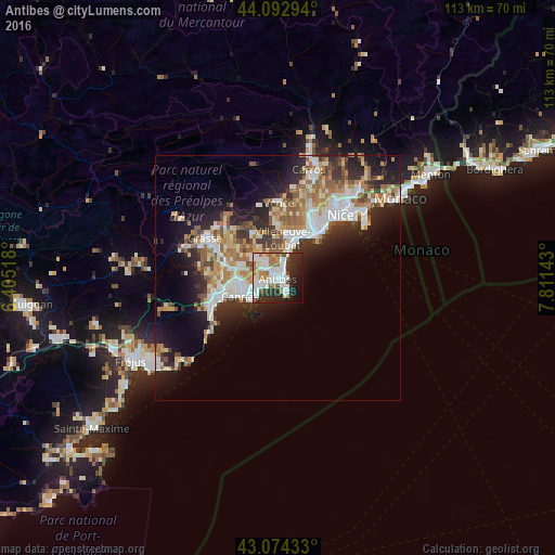
Analysis of Antibes night lights 2016
Square area 10x10 km:
 20.3%
20.3%90-99
16.21%80-89
3.48%70-79
2.73%60-69
9.55%50-59
4.55%40-49
2.27%30-39
8.18%20-29
17.58%10-19
11.52%0-9
3.64%Square area 50x50 km:
4.2%90-99
5.06%80-89
2.33%70-79
2.51%60-69
3.57%50-59
3.42%40-49
2.35%30-39
3.03%20-29
6.29%10-19
9.52%0-9
57.72%Clear (daylight) street map image can be seen on geolist.org.
Map coordinates:
44° 5' 34.6" North, 6° 24' 18.6" East
43° 35' 8.8" North, 7° 6' 29.9" East
43° 4' 27.6" North, 7° 48' 41.1" East
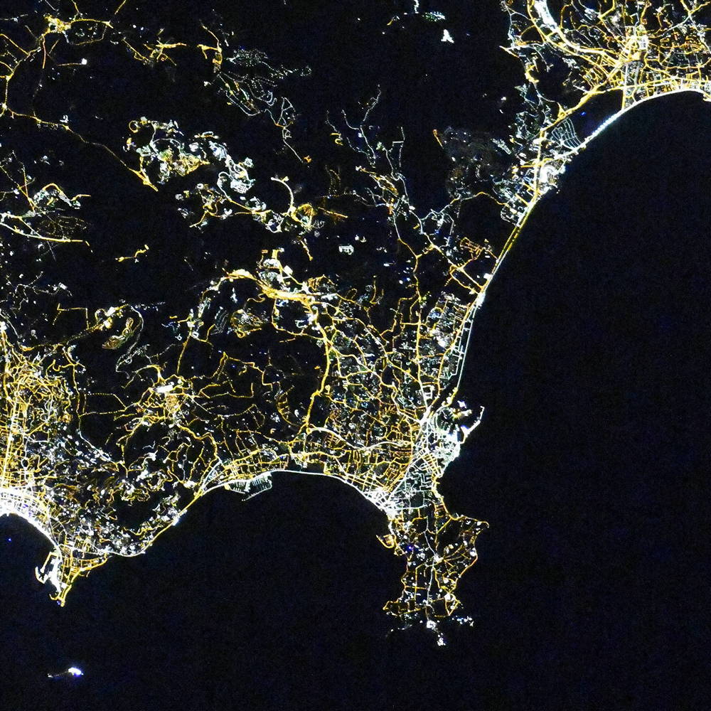
Fantastic image of Antibes from space taken by astronauts [src2], but I don't have information about it's orientation, scale or angle. If necessary, it was rotated manually, so North points approximately to upper direction. Click to zoom in:
Some cities around Antibes sort by population:
• Cannes
8.6 km =5.3 mi,  243°
243°
• Cagnes-sur-Mer
9.2 km =5.7 mi,  20°
20°
• Le Cannet
7.3 km =4.5 mi,  261°
261°
• Vallauris
4.4 km =2.7 mi, 258°
• Mougins
9.3 km =5.8 mi,  280°
280°
• Villeneuve-Loubet
8.1 km =5 mi,  8°
8°
• Valbonne
10.2 km =6.3 mi,  300°
300°
• Biot
4.9 km =3 mi,  347°
347°
3037456 (p: 76,393)
Sources (retrieved 2019-11-25):
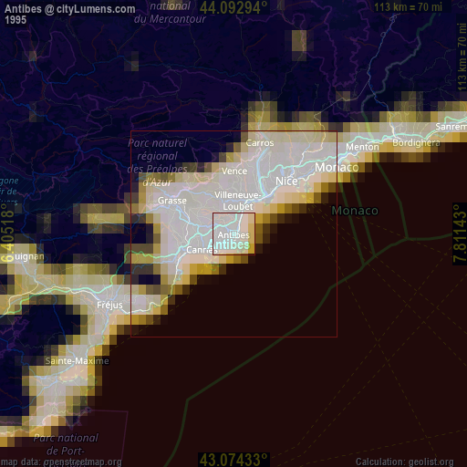
» NASA, Earths city lights 1995
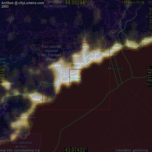
» NASA city lights 2003
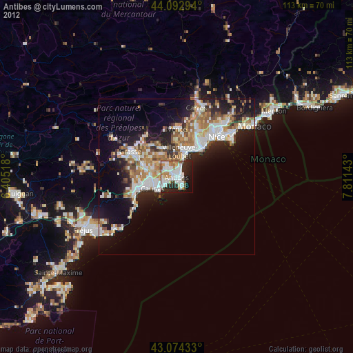
» Earth at Night: Flat Maps 2012, 2016
Src.2: picture by Oleg Kononenko, Roscosmos, retrieved 2019-11-29