Valbonne night lights from space
Night Light of Valbonne (Provence-Alpes-Côte d'Azur) from space (France) Src. Average luminocity for 10x10km area is 72.5818% and for 50x50km: 24.1758%.
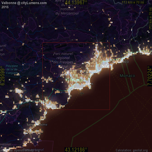
Analysis of Valbonne night lights 2016
Square area 10x10 km:
 7.27%
7.27%90-99
20.3%80-89
13.48%70-79
13.64%60-69
19.09%50-59
13.64%40-49
5.91%30-39
5.45%20-29
1.21%10-19
0%0-9
0%Square area 50x50 km:
4.48%90-99
5.61%80-89
2.33%70-79
2.62%60-69
3.63%50-59
3.51%40-49
2.58%30-39
3.33%20-29
6.26%10-19
9.77%0-9
55.89%Clear (daylight) street map image can be seen on geolist.org.
Map coordinates:
44° 8' 22.8" North, 6° 17' 45.6" East
43° 37' 58.5" North, 6° 59' 56.8" East
43° 7' 18.7" North, 7° 42' 8.1" East
Some cities around Valbonne sort by population:
• Cannes
9.1 km =5.7 mi,  173°
173°
• Grasse
6.5 km =4 mi,  295°
295°
• Le Cannet
6.5 km =4 mi, 165°
• Vallauris
7.6 km =4.7 mi,  143°
143°
• Mougins
3.6 km =2.2 mi,  184°
184°
• Mouans-Sartoux
2.6 km =1.6 mi,  239°
239°
• Biot
7.8 km =4.8 mi,  93°
93°
• Pégomas
6.7 km =4.2 mi,  233°
233°
2971117 (p: 12,633)
Sources (retrieved 2019-11-25):
» Earth at Night: Flat Maps 2012, 2016