Brest night lights from space
Night Light of Brest (Brittany) from space (France) Src. Average luminocity for 10x10km area is 55.7969% and for 50x50km: 4.716%.
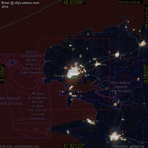
Analysis of Brest night lights 2016
Square area 10x10 km:
 18.47%
90-99
19.32%80-89
0.85%70-79
2.56%60-69
3.98%50-59
4.4%40-49
3.55%30-39
3.55%20-29
22.3%10-19
18.18%0-9
2.84%Square area 50x50 km:
0.94%90-99
1.08%80-89
0.16%70-79
0.34%60-69
0.6%50-59
0.45%40-49
0.44%30-39
0.53%20-29
1.58%10-19
3.16%0-9
90.72%Clear (daylight) street map image can be seen on geolist.org.
Map coordinates:
48° 51' 18.2" North, 5° 11' 21.8" West
48° 23' 25" North, 4° 29' 10.6" West
47° 55' 16.4" North, 3° 46' 59.3" West
Some cities around Brest sort by population:
• Guipavas
8.3 km =5.2 mi,  52°
52°
• Plougastel-Daoulas
9.2 km =5.7 mi,  106°
106°
• Plouzané
9.7 km =6 mi,  265°
265°
• Le Relecq-Kerhuon
7.1 km =4.4 mi,  74°
74°
• Rd pt des Chataigniers, Rte de Milizac, Guilers, Finistère, France
7.7 km =4.8 mi,  308°
308°
• Guilers
6.6 km =4.1 mi, 306°
• Saint-Renan
10.7 km =6.6 mi,  296°
296°
• Gouesnou
7.1 km =4.4 mi,  13°
13°
3030300 (p: 144,899)
Sources (retrieved 2019-11-25):
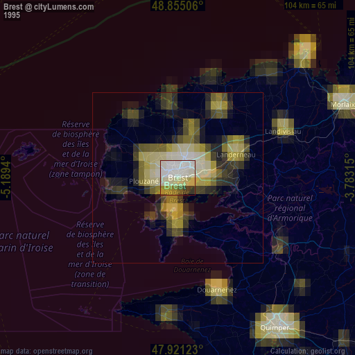
» NASA, Earths city lights 1995
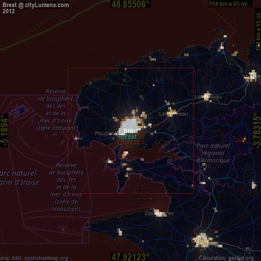
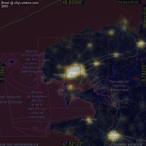
» NASA city lights 2003
» Earth at Night: Flat Maps 2012, 2016