Rd pt des Chataigniers, Rte de Milizac, Guilers, Finistère, France night lights from space
Night Light of Rd pt des Chataigniers, Rte de Milizac, Guilers, Finistère, France (Brittany) from space (France) Src. Average luminocity for 10x10km area is 17.7116% and for 50x50km: 4.699%.
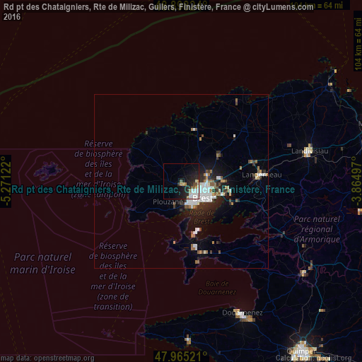
Analysis of Rd pt des Chataigniers, Rte de Milizac, Guilers, Finistère, France night lights 2016
Square area 10x10 km:
 3.41%
3.41%90-99
4.83%80-89
0.43%70-79
1.56%60-69
1.85%50-59
1.56%40-49
1.14%30-39
0.43%20-29
8.66%10-19
15.48%0-9
60.65%Square area 50x50 km:
0.94%90-99
1.08%80-89
0.16%70-79
0.34%60-69
0.61%50-59
0.46%40-49
0.44%30-39
0.5%20-29
1.57%10-19
3.16%0-9
90.75%Clear (daylight) street map image can be seen on geolist.org.
Map coordinates:
48° 53' 53.7" North, 5° 16' 16.4" West
48° 26' 1.9" North, 4° 34' 5.1" West
47° 57' 54.8" North, 3° 51' 53.9" West
Some cities around Rd pt des Chataigniers, Rte de Milizac, Guilers, Finistère, France sort by population:
• Brest
7.7 km =4.8 mi,  128°
128°
• Guipavas
12.6 km =7.8 mi,  89°
89°
• Plouzané
6.7 km =4.2 mi,  212°
212°
• Plabennec
12.9 km =8 mi,  53°
53°
• Guilers
1.2 km =0.7 mi,  141°
141°
• Saint-Renan
3.6 km =2.2 mi,  269°
269°
• Gouesnou
7.9 km =4.9 mi,  74°
74°
• Ploudalmézeau
12.6 km =7.8 mi,  331°
331°
11238455 (p: 8,000)
Sources (retrieved 2019-11-25):
» Earth at Night: Flat Maps 2012, 2016