Beaupréau night lights from space
Night Light of Beaupréau (Pays de la Loire) from space (France) Src. Average luminocity for 10x10km area is 2.9688% and for 50x50km: 4.2325%.
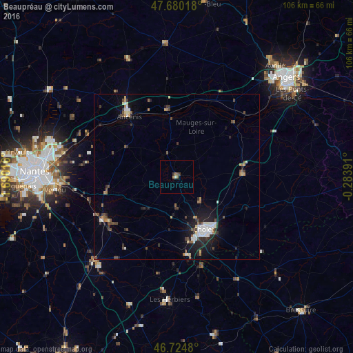
Analysis of Beaupréau night lights 2016
Square area 10x10 km:
 0%
0%90-99
0.6%80-89
0%70-79
0.6%60-69
1.19%50-59
0.6%40-49
0%30-39
1.19%20-29
0%10-19
0%0-9
95.83%Square area 50x50 km:
0.62%90-99
0.67%80-89
0.34%70-79
0.31%60-69
0.4%50-59
0.64%40-49
0.79%30-39
0.63%20-29
1.07%10-19
2.71%0-9
91.82%Clear (daylight) street map image can be seen on geolist.org.
Map coordinates:
47° 40' 48.6" North, 1° 41' 24.6" West
47° 12' 16.7" North, 0° 59' 13.3" West
46° 43' 29.3" North, 0° 17' 2.1" West
Some cities around Beaupréau sort by population:
• Cholet
18.1 km =11.2 mi,  153°
153°
• Ancenis
22.5 km =14 mi,  323°
323°
• Vallet
21.6 km =13.4 mi,  257°
257°
• Chemillé-Melay
19.8 km =12.3 mi,  86°
86°
• Clisson
25.9 km =16.1 mi,  239°
239°
• Mortagne-sur-Sèvre
23.8 km =14.8 mi,  172°
172°
• Saint-Macaire-en-Mauges
9 km =5.6 mi,  182°
182°
• Chalonnes-sur-Loire
23.5 km =14.6 mi,  45°
45°
3034111 (p: 6,932)
Sources (retrieved 2019-11-25):
» Earth at Night: Flat Maps 2012, 2016