Avon night lights from space
Night Light of Avon (Île-de-France) from space (France) Src. Average luminocity for 10x10km area is 23.8807% and for 50x50km: 13.5467%.
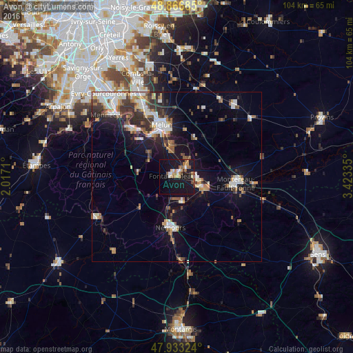
Analysis of Avon night lights 2016
Square area 10x10 km:
 1.85%
1.85%90-99
2.98%80-89
2.56%70-79
3.84%60-69
4.12%50-59
3.98%40-49
0.57%30-39
0.99%20-29
0.99%10-19
50.28%0-9
27.84%Square area 50x50 km:
2.37%90-99
2.57%80-89
0.9%70-79
1.49%60-69
1.61%50-59
1.76%40-49
1.46%30-39
2.59%20-29
3.03%10-19
9.85%0-9
72.37%Clear (daylight) street map image can be seen on geolist.org.
Map coordinates:
48° 52' 0.7" North, 2° 1' 1.6" East
48° 24' 7.9" North, 2° 43' 12.8" East
47° 55' 59.7" North, 3° 25' 24.1" East
Some cities around Avon sort by population:
• Dammarie-les-Lys
13.7 km =8.5 mi,  337°
337°
• Fontainebleau
1.6 km =1 mi,  299°
299°
• Nemours
14.3 km =8.9 mi,  188°
188°
• Vaux-le-Pénil
14.1 km =8.8 mi,  351°
351°
• Champagne-sur-Seine
5.8 km =3.6 mi,  94°
94°
• Saint-Pierre-lès-Nemours
15.3 km =9.5 mi, 191°
• Bois-le-Roi
8 km =5 mi, 351°
• Veneux-les-Sablons
6.1 km =3.8 mi,  115°
115°
3035654 (p: 15,009)
Sources (retrieved 2019-11-25):
» Earth at Night: Flat Maps 2012, 2016