Annecy night lights from space
Night Light of Annecy (Auvergne-Rhône-Alpes) from space (France) Src. Average luminocity for 10x10km area is 60.5402% and for 50x50km: 9.9217%.
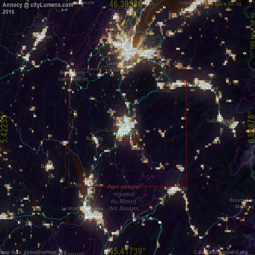
Analysis of Annecy night lights 2016
Square area 10x10 km:
 15.48%
90-99
19.05%80-89
6.1%70-79
5.95%60-69
5.06%50-59
5.8%40-49
4.17%30-39
7.89%20-29
16.22%10-19
13.54%0-9
0.74%Square area 50x50 km:
1.23%90-99
1.59%80-89
0.84%70-79
0.84%60-69
1.22%50-59
1.2%40-49
1.32%30-39
1.47%20-29
2.84%10-19
9.24%0-9
78.21%Clear (daylight) street map image can be seen on geolist.org.
Map coordinates:
46° 23' 45.1" North, 5° 25' 21.1" East
45° 54' 31.6" North, 6° 7' 32.3" East
45° 25' 2.6" North, 6° 49' 43.6" East
Some cities around Annecy sort by population:
• Cran-Gevrier
2.2 km =1.4 mi,  243°
243°
• Seynod
3.9 km =2.4 mi,  228°
228°
• Rumilly
14.9 km =9.3 mi,  249°
249°
• Meythet
2.7 km =1.7 mi,  293°
293°
• Faverges
21.7 km =13.5 mi,  143°
143°
• Poisy
5 km =3.1 mi, 286°
• Thônes
15.8 km =9.8 mi,  101°
101°
• Saint-Jorioz
9 km =5.6 mi,  163°
163°
3037543 (p: 49,232)
Sources (retrieved 2019-11-25):
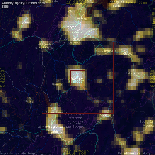
» NASA, Earths city lights 1995
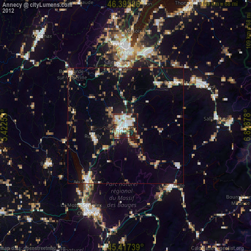
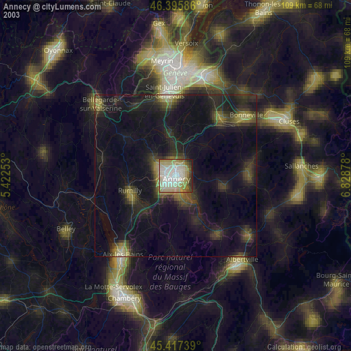
» NASA city lights 2003
» Earth at Night: Flat Maps 2012, 2016