Angers night lights from space
Night Light of Angers (Pays de la Loire) from space (France) Src. Average luminocity for 10x10km area is 63.919% and for 50x50km: 4.3157%.
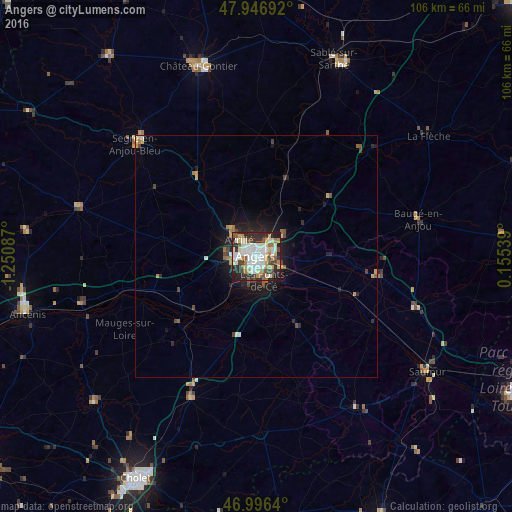
Analysis of Angers night lights 2016
Square area 10x10 km:
 17.9%
17.9%90-99
17.47%80-89
6.96%70-79
7.1%60-69
5.4%50-59
6.82%40-49
7.24%30-39
5.68%20-29
18.75%10-19
6.68%0-9
0%Square area 50x50 km:
0.78%90-99
0.79%80-89
0.46%70-79
0.49%60-69
0.44%50-59
0.5%40-49
0.68%30-39
0.31%20-29
1.39%10-19
2.9%0-9
91.27%Clear (daylight) street map image can be seen on geolist.org.
Map coordinates:
47° 56' 48.9" North, 1° 15' 3.1" West
47° 28' 25.7" North, 0° 32' 51.9" West
46° 59' 47" North, 0° 9' 19.4" East
Some cities around Angers sort by population:
• Avrillé
4 km =2.5 mi,  317°
317°
• Les Ponts-de-Cé
5.9 km =3.7 mi,  162°
162°
• Trélazé
6.9 km =4.3 mi,  116°
116°
• Juigné
29.6 km =18.4 mi,  22°
22°
• Bouchemaine
7.3 km =4.5 mi,  218°
218°
• Chalonnes-sur-Loire
21.1 km =13.1 mi,  230°
230°
• Beaufort-en-Vallée
25 km =15.5 mi,  98°
98°
• Mûrs-Erigné
8.2 km =5.1 mi,  181°
181°
3037656 (p: 168,279)
Sources (retrieved 2019-11-25):
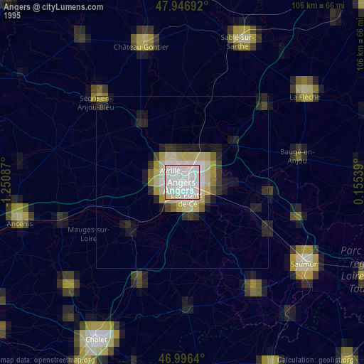
» NASA, Earths city lights 1995
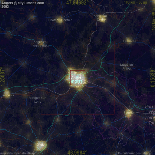
» NASA city lights 2003
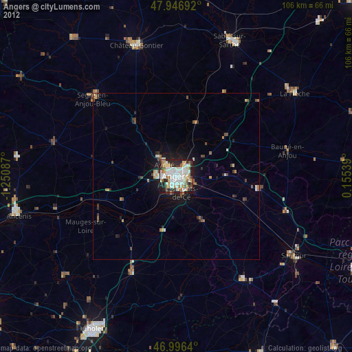
» Earth at Night: Flat Maps 2012, 2016