Somero night lights from space
Night Light of Somero (Southwest Finland) from space (Finland) Src. Average luminocity for 10x10km area is 2.6271% and for 50x50km: 2.0268%.
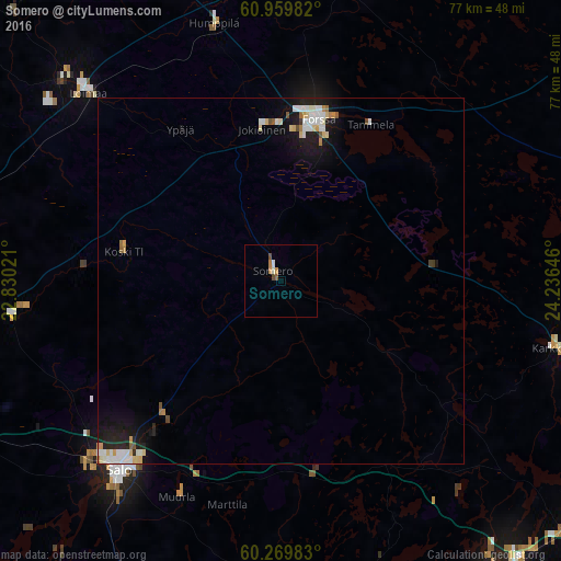
Analysis of Somero night lights 2016
Square area 10x10 km:
 0%
0%90-99
0.83%80-89
0%70-79
0.83%60-69
0.41%50-59
0.41%40-49
0.83%30-39
0%20-29
0%10-19
0%0-9
96.69%Square area 50x50 km:
0.36%90-99
0.52%80-89
0.29%70-79
0.2%60-69
0.16%50-59
0.13%40-49
0.14%30-39
0.03%20-29
0.36%10-19
1.73%0-9
96.09%Clear (daylight) street map image can be seen on geolist.org.
Map coordinates:
60° 57' 35.4" North, 22° 49' 48.8" East
60° 37' 0" North, 23° 31' 60" East
60° 16' 11.4" North, 24° 14' 11.3" East
Some cities around Somero sort by population:
• Vihti
48.4 km =30.1 mi,  117°
117°
• Salo
34 km =21.1 mi,  220°
220°
• Forssa
22.5 km =14 mi,  12°
12°
• Paimio
49.6 km =30.8 mi,  248°
248°
• Halikko
34.5 km =21.4 mi,  225°
225°
• Karkkila
38.1 km =23.7 mi,  103°
103°
• Tammela
25 km =15.5 mi,  30°
30°
• Jokioinen
20.8 km =12.9 mi,  351°
351°
636345 (p: 9,840)
Sources (retrieved 2019-11-25):
» Earth at Night: Flat Maps 2012, 2016