Rovaniemi night lights from space
Night Light of Rovaniemi (Lapland) from space (Finland) Src. Average luminocity for 10x10km area is 62.2901% and for 50x50km: 4.0075%.
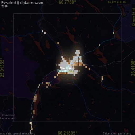
Analysis of Rovaniemi night lights 2016
Square area 10x10 km:
 21.96%
90-99
20.37%80-89
1.94%70-79
4.41%60-69
5.73%50-59
2.82%40-49
1.94%30-39
9.44%20-29
17.55%10-19
12.08%0-9
1.76%Square area 50x50 km:
1.05%90-99
1.02%80-89
0.13%70-79
0.32%60-69
0.46%50-59
0.25%40-49
0.22%30-39
0.53%20-29
1.37%10-19
2.38%0-9
92.27%Clear (daylight) street map image can be seen on geolist.org.
Map coordinates:
66° 46' 43.7" North, 25° 0' 48.8" East
66° 30' 0" North, 25° 43' 0" East
66° 13' 5" North, 26° 25' 11.3" East
Some cities around Rovaniemi sort by population:
• Kemi
99.5 km =61.8 mi,  211°
211°
• Tornio
101.1 km =62.8 mi,  224°
224°
• Keminmaa
93.8 km =58.3 mi, 214°
• Sodankylä
108.9 km =67.7 mi,  20°
20°
• Kemijärvi
79.3 km =49.3 mi,  72°
72°
• Haparanda, SE
102.5 km =63.7 mi, 223°
• Pyhäjärvi
91.4 km =56.8 mi,  46°
46°
• Ylitornio
93.2 km =57.9 mi,  256°
256°
638936 (p: 34,781)
Sources (retrieved 2019-11-25):
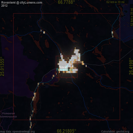
» Earth at Night: Flat Maps 2012, 2016