Shakiso night lights from space
Night Light of Shakiso (Oromiya) from space (Ethiopia) Src. Average luminocity for 10x10km area is 3.1756% and for 50x50km: 0.1907%.
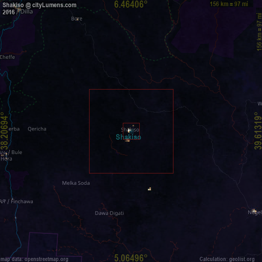
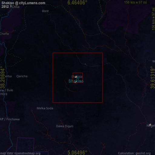
Analysis of Shakiso night lights 2016
Square area 10x10 km:
 0.62%
0.62%90-99
0.21%80-89
0%70-79
0.83%60-69
0%50-59
0%40-49
1.65%30-39
1.65%20-29
0%10-19
0%0-9
95.04%Square area 50x50 km:
0.03%90-99
0.01%80-89
0%70-79
0.03%60-69
0.03%50-59
0%40-49
0.11%30-39
0.09%20-29
0.03%10-19
0%0-9
99.66%Clear (daylight) street map image can be seen on geolist.org.
Map coordinates:
6° 27' 50.6" North, 38° 12' 25" East
5° 45' 53.8" North, 38° 54' 36.2" East
5° 3' 53.9" North, 39° 36' 47.5" East
Some cities around Shakiso sort by population:
• Dīla
97.8 km =60.8 mi,  317°
317°
• Yirga ‘Alem
122.4 km =76.1 mi,  333°
333°
• Kibre Mengist
15.5 km =9.6 mi,  31°
31°
• Hagere Maryam
76 km =47.2 mi,  258°
258°
• Yabēlo
134.1 km =83.3 mi,  223°
223°
• Wendo
107.7 km =66.9 mi, 329°
• Leku
133.5 km =83 mi,  337°
337°
• Hāgere Selam
90.9 km =56.5 mi, 331°
328716 (p: 34,078)
Sources (retrieved 2019-11-25):
» Earth at Night: Flat Maps 2012, 2016