Villamuriel de Cerrato night lights from space
Night Light of Villamuriel de Cerrato (Castille and León) from space (Spain) Src. Average luminocity for 10x10km area is 32.9587% and for 50x50km: 4.7903%.
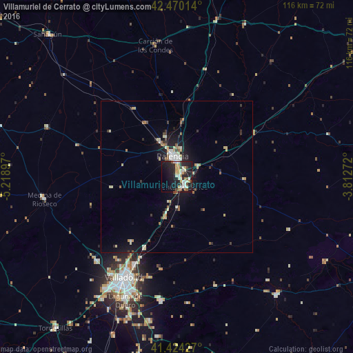
Analysis of Villamuriel de Cerrato night lights 2016
Square area 10x10 km:
 3.49%
3.49%90-99
7.94%80-89
3.65%70-79
4.76%60-69
3.49%50-59
2.7%40-49
3.17%30-39
2.86%20-29
15.08%10-19
33.17%0-9
19.68%Square area 50x50 km:
0.44%90-99
0.92%80-89
0.69%70-79
0.47%60-69
0.67%50-59
0.44%40-49
0.31%30-39
0.61%20-29
1.38%10-19
4.32%0-9
89.75%Clear (daylight) street map image can be seen on geolist.org.
Map coordinates:
42° 28' 12.5" North, 5° 13' 8.3" West
41° 56' 57.7" North, 4° 30' 57" West
41° 25' 27.4" North, 3° 48' 45.8" West
Some cities around Villamuriel de Cerrato sort by population:
• Valladolid
37 km =23 mi,  207°
207°
• Palencia
6.7 km =4.2 mi,  354°
354°
• Laguna de Duero
44.4 km =27.6 mi,  202°
202°
• Arroyo de la Encomienda
44.4 km =27.6 mi, 211°
• Tudela de Duero
40.9 km =25.4 mi,  187°
187°
• Cistérniga
40 km =24.9 mi, 200°
• Venta de Baños
3.8 km =2.4 mi,  146°
146°
• Medina de Ríoseco
44.3 km =27.5 mi,  260°
260°
3105331 (p: 5,437)
Sources (retrieved 2019-11-25):
» Earth at Night: Flat Maps 2012, 2016