Palencia night lights from space
Night Light of Palencia (Castille and León) from space (Spain) Src. Average luminocity for 10x10km area is 39.8159% and for 50x50km: 4.4065%.
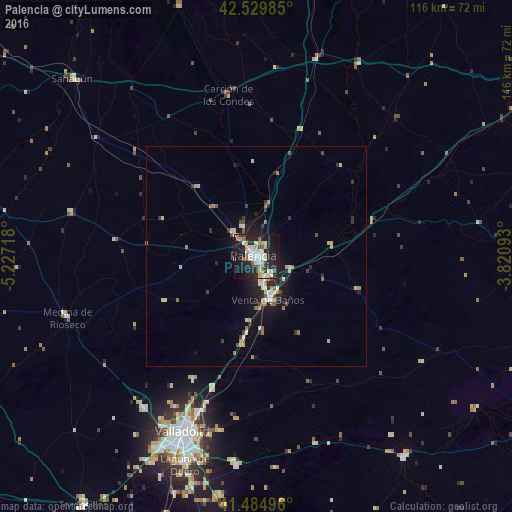
Analysis of Palencia night lights 2016
Square area 10x10 km:
 7.14%
7.14%90-99
10%80-89
5.4%70-79
3.97%60-69
3.17%50-59
4.6%40-49
0.63%30-39
3.02%20-29
17.14%10-19
35.71%0-9
9.21%Square area 50x50 km:
0.4%90-99
0.84%80-89
0.65%70-79
0.41%60-69
0.7%50-59
0.39%40-49
0.33%30-39
0.57%20-29
1.34%10-19
3.78%0-9
90.59%Clear (daylight) street map image can be seen on geolist.org.
Map coordinates:
42° 31' 47.5" North, 5° 13' 37.8" West
42° 0' 34.4" North, 4° 31' 26.6" West
41° 29' 5.9" North, 3° 49' 15.3" West
Some cities around Palencia sort by population:
• Valladolid
42.7 km =26.5 mi,  202°
202°
• Laguna de Duero
50.4 km =31.3 mi, 199°
• Arroyo de la Encomienda
49.9 km =31 mi,  206°
206°
• Tudela de Duero
47.5 km =29.5 mi,  185°
185°
• Cistérniga
46.1 km =28.6 mi, 197°
• Venta de Baños
10.2 km =6.3 mi,  164°
164°
• Villamuriel de Cerrato
6.7 km =4.2 mi,  174°
174°
• Medina de Ríoseco
45.2 km =28.1 mi,  251°
251°
3114531 (p: 82,651)
Sources (retrieved 2019-11-25):
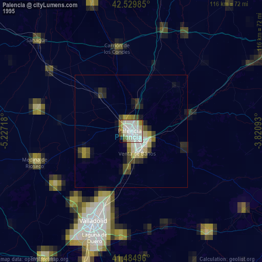
» NASA, Earths city lights 1995
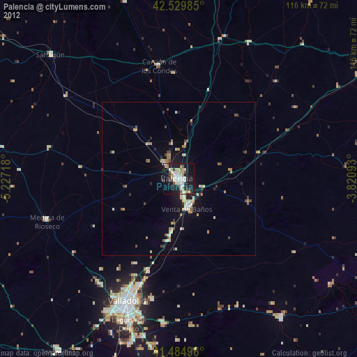
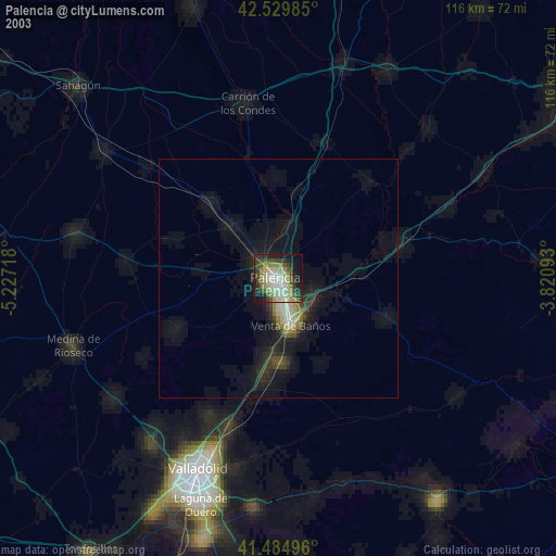
» NASA city lights 2003
» Earth at Night: Flat Maps 2012, 2016