Tudela de Duero night lights from space
Night Light of Tudela de Duero (Castille and León) from space (Spain) Src. Average luminocity for 10x10km area is 10.6737% and for 50x50km: 11.5379%.
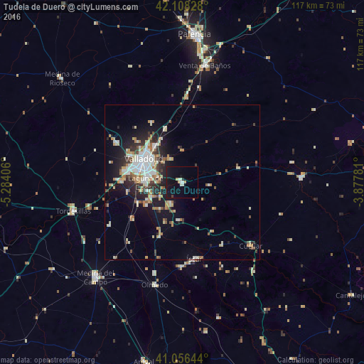
Analysis of Tudela de Duero night lights 2016
Square area 10x10 km:
 0.97%
0.97%90-99
2.92%80-89
1.3%70-79
0.65%60-69
0%50-59
0%40-49
0.65%30-39
0%20-29
0.65%10-19
14.94%0-9
77.92%Square area 50x50 km:
1.67%90-99
2.67%80-89
1.24%70-79
1.27%60-69
1.61%50-59
1.04%40-49
0.79%30-39
1.38%20-29
3.2%10-19
6.87%0-9
78.25%Clear (daylight) street map image can be seen on geolist.org.
Map coordinates:
42° 6' 29.8" North, 5° 17' 2.6" West
41° 35' 4.2" North, 4° 34' 51.3" West
41° 3' 23.2" North, 3° 52' 40.1" West
Some cities around Tudela de Duero sort by population:
• Valladolid
14.2 km =8.8 mi,  303°
303°
• Laguna de Duero
11.8 km =7.3 mi,  268°
268°
• Arroyo de la Encomienda
18.2 km =11.3 mi,  278°
278°
• Cuéllar
30.1 km =18.7 mi,  132°
132°
• Tordesillas
36.2 km =22.5 mi,  255°
255°
• Iscar
25.1 km =15.6 mi,  170°
170°
• Cistérniga
9.4 km =5.8 mi,  289°
289°
• Venta de Baños
38.2 km =23.7 mi,  11°
11°
3107415 (p: 6,302)
Sources (retrieved 2019-11-25):
» Earth at Night: Flat Maps 2012, 2016