Tarragona night lights from space
Night Light of Tarragona (Catalonia) from space (Spain) Src. Average luminocity for 10x10km area is 60.3247% and for 50x50km: 17.9547%.
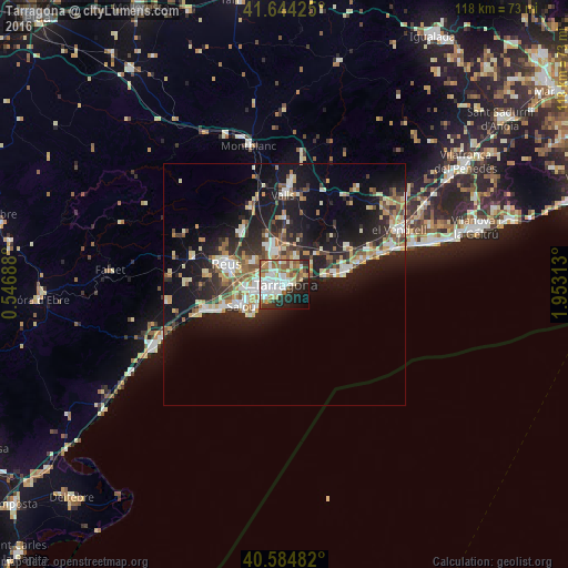

Analysis of Tarragona night lights 2016
Square area 10x10 km:
 15.75%
90-99
15.58%80-89
5.84%70-79
6.98%60-69
9.42%50-59
8.12%40-49
3.73%30-39
6.01%20-29
13.15%10-19
11.53%0-9
3.9%Square area 50x50 km:
2.46%90-99
3.17%80-89
2.23%70-79
2.26%60-69
2.15%50-59
2.6%40-49
1.5%30-39
2.65%20-29
6.04%10-19
14.72%0-9
60.22%Clear (daylight) street map image can be seen on geolist.org.
Map coordinates:
41° 38' 39.3" North, 0° 32' 48.8" East
41° 7' 0" North, 1° 15' 0" East
40° 35' 5.4" North, 1° 57' 11.3" East
Some cities around Tarragona sort by population:
• Reus
12.8 km =8 mi,  290°
290°
• Cambrils
16.8 km =10.4 mi,  251°
251°
• Salou
10.1 km =6.3 mi,  243°
243°
• Vila-seca
8.6 km =5.3 mi,  265°
265°
• La Pineda
7.1 km =4.4 mi,  230°
230°
• Torredembarra
12.8 km =8 mi,  75°
75°
• La Canonja
5.8 km =3.6 mi, 274°
• Constantí
5.2 km =3.2 mi,  322°
322°
3108288 (p: 140,323)
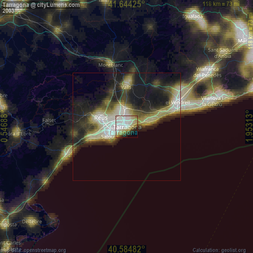
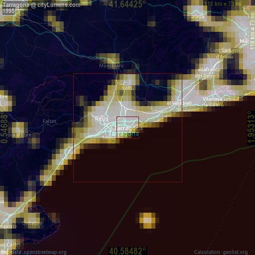
Sources (retrieved 2019-11-25):
» NASA, Earths city lights 1995
» NASA city lights 2003
» Earth at Night: Flat Maps 2012, 2016