Sallent night lights from space
Night Light of Sallent (Catalonia) from space (Spain) Src. Average luminocity for 10x10km area is 22.2556% and for 50x50km: 9.4482%.
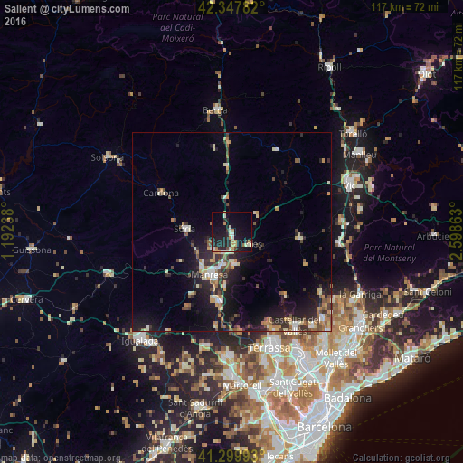
Analysis of Sallent night lights 2016
Square area 10x10 km:
 2.06%
2.06%90-99
3.65%80-89
2.22%70-79
3.97%60-69
2.38%50-59
0.63%40-49
1.27%30-39
2.38%20-29
10.95%10-19
27.62%0-9
42.86%Square area 50x50 km:
0.73%90-99
1.31%80-89
1.24%70-79
1.24%60-69
1.15%50-59
1.18%40-49
1.26%30-39
1.55%20-29
3.45%10-19
8.01%0-9
78.88%Clear (daylight) street map image can be seen on geolist.org.
Map coordinates:
42° 20' 52.2" North, 1° 11' 32.6" East
41° 49' 33.7" North, 1° 53' 43.8" East
41° 17' 59.7" North, 2° 35' 55.1" East
Some cities around Sallent sort by population:
• Manresa
12.4 km =7.7 mi,  208°
208°
• Sant Joan de Vilatorrada
11.7 km =7.3 mi,  220°
220°
• Sant Vicenç de Castellet
17.9 km =11.1 mi,  187°
187°
• Súria
12.1 km =7.5 mi,  273°
273°
• Navàs
8.4 km =5.2 mi,  349°
349°
• Navarcles
8.3 km =5.2 mi,  175°
175°
• Cardona
20.4 km =12.7 mi,  298°
298°
• Moià
16.9 km =10.5 mi,  95°
95°
3111003 (p: 7,107)
Sources (retrieved 2019-11-25):
» Earth at Night: Flat Maps 2012, 2016