Sagunto night lights from space
Night Light of Sagunto (Valencia) from space (Spain) Src. Average luminocity for 10x10km area is 50.1006% and for 50x50km: 22.319%.
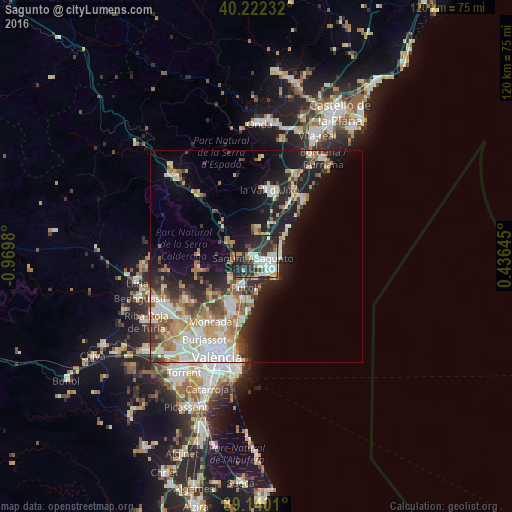
Analysis of Sagunto night lights 2016
Square area 10x10 km:
 12.18%
90-99
12.66%80-89
3.73%70-79
4.38%60-69
3.25%50-59
3.57%40-49
6.01%30-39
8.93%20-29
29.71%10-19
14.77%0-9
0.81%Square area 50x50 km:
4.68%90-99
4.33%80-89
2.25%70-79
2.84%60-69
3.39%50-59
2.43%40-49
2.43%30-39
2.65%20-29
5.69%10-19
11.34%0-9
57.96%Clear (daylight) street map image can be seen on geolist.org.
Map coordinates:
40° 13' 20.4" North, 0° 58' 11.3" West
39° 40' 60" North, 0° 16' 0" West
39° 8' 24.4" North, 0° 26' 11.2" East
Some cities around Sagunto sort by population:
• Grao de Murviedro
5.2 km =3.2 mi,  152°
152°
• Puçol
7.9 km =4.9 mi,  201°
201°
• Massamagrell
14.2 km =8.8 mi, 203°
• Meliana
17.6 km =10.9 mi, 198°
• Puig
11 km =6.8 mi, 196°
• La Pobla de Farnals
13.2 km =8.2 mi,  186°
186°
• Foios
18.1 km =11.2 mi, 203°
• Almenara
8.6 km =5.3 mi,  29°
29°
2511619 (p: 66,070)
Sources (retrieved 2019-11-25):
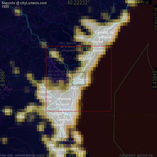
» NASA, Earths city lights 1995
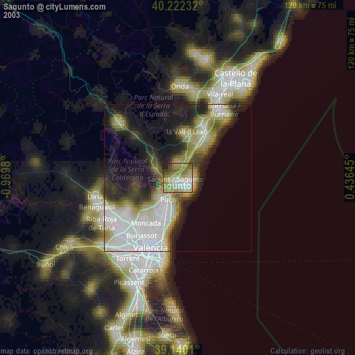
» NASA city lights 2003
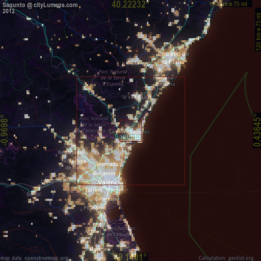
» Earth at Night: Flat Maps 2012, 2016