Redován night lights from space
Night Light of Redován (Valencia) from space (Spain) Src. Average luminocity for 10x10km area is 61.099% and for 50x50km: 31.9134%.
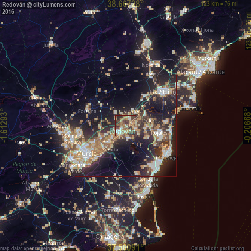
Analysis of Redován night lights 2016
Square area 10x10 km:
 4.87%
4.87%90-99
9.58%80-89
9.58%70-79
12.5%60-69
13.96%50-59
12.66%40-49
17.86%30-39
12.01%20-29
6.98%10-19
0%0-9
0%Square area 50x50 km:
4.09%90-99
5.26%80-89
4.05%70-79
4.82%60-69
4.99%50-59
3.69%40-49
4.62%30-39
5.59%20-29
11.56%10-19
19.42%0-9
31.9%Clear (daylight) street map image can be seen on geolist.org.
Map coordinates:
38° 40' 2.2" North, 1° 36' 46.5" West
38° 6' 58.3" North, 0° 54' 35.3" West
37° 33' 39.3" North, 0° 12' 24" West
Some cities around Redován sort by population:
• Orihuela
4.6 km =2.9 mi,  220°
220°
• Almoradí
10.3 km =6.4 mi,  94°
94°
• Callosa de Segura
2.9 km =1.8 mi,  70°
70°
• Albatera
7.8 km =4.8 mi,  26°
26°
• Cox
3.4 km =2.1 mi, 34°
• Catral
10.6 km =6.6 mi,  62°
62°
• Bigastro
6.1 km =3.8 mi,  170°
170°
• Benejúzar
7.5 km =4.7 mi,  125°
125°
2511969 (p: 6,507)
Sources (retrieved 2019-11-25):
» Earth at Night: Flat Maps 2012, 2016