Parres night lights from space
Night Light of Parres (Asturias) from space (Spain) Src. Average luminocity for 10x10km area is 4.3429% and for 50x50km: 1.5251%.
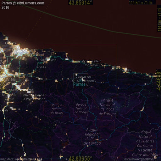
Analysis of Parres night lights 2016
Square area 10x10 km:
 0.79%
0.79%90-99
1.11%80-89
0.32%70-79
0.63%60-69
0%50-59
0.63%40-49
0.32%30-39
1.59%20-29
0.63%10-19
0%0-9
93.97%Square area 50x50 km:
0.12%90-99
0.18%80-89
0.05%70-79
0.15%60-69
0.35%50-59
0.27%40-49
0.3%30-39
0.32%20-29
0.63%10-19
0.27%0-9
97.36%Clear (daylight) street map image can be seen on geolist.org.
Map coordinates:
43° 51' 32.9" North, 5° 51' 11.3" West
43° 21' 0" North, 5° 9' 0" West
42° 50' 11.6" North, 4° 26' 48.8" West
Some cities around Parres sort by population:
• Villaviciosa
27.3 km =17 mi,  302°
302°
• Pola de Laviana
35.4 km =22 mi,  250°
250°
• Llanes
32.9 km =20.4 mi,  76°
76°
• Pola de Siero
41.8 km =26 mi,  276°
276°
• Piloña
17.5 km =10.9 mi,  270°
270°
• El entrego
40.1 km =24.9 mi,  260°
260°
• Cangas de Onís
1.7 km =1.1 mi, 84°
• Ribadesella
14.4 km =8.9 mi,  30°
30°
3114245 (p: 5,749)
Sources (retrieved 2019-11-25):
» Earth at Night: Flat Maps 2012, 2016