Alella night lights from space
Night Light of Alella (Catalonia) from space (Spain) Src. Average luminocity for 10x10km area is 61.4082% and for 50x50km: 40.5929%.
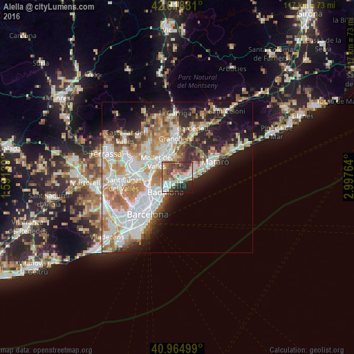
Analysis of Alella night lights 2016
Square area 10x10 km:
 12.76%
90-99
13.44%80-89
6.8%70-79
8.16%60-69
9.69%50-59
8.5%40-49
12.93%30-39
11.05%20-29
11.22%10-19
5.44%0-9
0%Square area 50x50 km:
10.77%90-99
9.72%80-89
3.98%70-79
5.17%60-69
6.75%50-59
4.61%40-49
3.21%30-39
3.47%20-29
6.59%10-19
11.28%0-9
34.43%Clear (daylight) street map image can be seen on geolist.org.
Map coordinates:
42° 1' 5.9" North, 1° 35' 29" East
41° 29' 37.6" North, 2° 17' 40.2" East
40° 57' 54" North, 2° 59' 51.5" East
Some cities around Alella sort by population:
• Badalona
6.2 km =3.9 mi,  218°
218°
• Premià de Mar
5.9 km =3.7 mi,  91°
91°
• El Masnou
2.6 km =1.6 mi,  127°
127°
• Montornès del Vallès
5.8 km =3.6 mi,  337°
337°
• Montgat
3.1 km =1.9 mi,  203°
203°
• Tiana
2.6 km =1.6 mi,  240°
240°
• Cabrils
7.3 km =4.5 mi,  59°
59°
• Teià
2.3 km =1.4 mi,  78°
78°
3130422 (p: 8,859)
Sources (retrieved 2019-11-25):
» Earth at Night: Flat Maps 2012, 2016