Montijo night lights from space
Night Light of Montijo (Extremadura) from space (Spain) Src. Average luminocity for 10x10km area is 13.1735% and for 50x50km: 4.5051%.
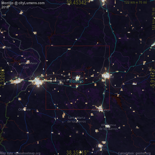
Analysis of Montijo night lights 2016
Square area 10x10 km:
 1.87%
1.87%90-99
2.38%80-89
1.87%70-79
1.36%60-69
1.36%50-59
0.51%40-49
0.68%30-39
0.85%20-29
2.04%10-19
3.4%0-9
83.67%Square area 50x50 km:
0.47%90-99
0.62%80-89
0.74%70-79
0.83%60-69
0.51%50-59
0.32%40-49
0.45%30-39
0.38%20-29
0.76%10-19
2.76%0-9
92.16%Clear (daylight) street map image can be seen on geolist.org.
Map coordinates:
39° 27' 12.3" North, 7° 19' 15.5" West
38° 54' 30.2" North, 6° 37' 4.3" West
38° 21' 32.9" North, 5° 54' 53" West
Some cities around Montijo sort by population:
• Badajoz
30.7 km =19.1 mi,  263°
263°
• Mérida
23.7 km =14.7 mi,  87°
87°
• Almendralejo
31 km =19.3 mi,  143°
143°
• Campo Maior, PT
40.5 km =25.2 mi,  287°
287°
• Calamonte
20 km =12.4 mi,  96°
96°
• Puebla de la Calzada
1.7 km =1.1 mi,  204°
204°
• Aceuchal
31.3 km =19.4 mi,  158°
158°
• Talavera La Real
13.5 km =8.4 mi, 255°
2513604 (p: 16,236)
Sources (retrieved 2019-11-25):
» Earth at Night: Flat Maps 2012, 2016