Talavera La Real night lights from space
Night Light of Talavera La Real (Extremadura) from space (Spain) Src. Average luminocity for 10x10km area is 7.2007% and for 50x50km: 4.7684%.
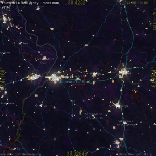
Analysis of Talavera La Real night lights 2016
Square area 10x10 km:
 0%
0%90-99
0%80-89
2.72%70-79
0.68%60-69
0.51%50-59
0.85%40-49
2.04%30-39
0.68%20-29
2.04%10-19
0.68%0-9
89.8%Square area 50x50 km:
0.66%90-99
0.71%80-89
0.7%70-79
0.68%60-69
0.45%50-59
0.35%40-49
0.45%30-39
0.41%20-29
1.33%10-19
3.21%0-9
91.06%Clear (daylight) street map image can be seen on geolist.org.
Map coordinates:
39° 25' 23.5" North, 7° 28' 18.1" West
38° 52' 40.6" North, 6° 46' 6.8" West
38° 19' 42.5" North, 6° 3' 55.6" West
Some cities around Talavera La Real sort by population:
• Badajoz
17.5 km =10.9 mi,  269°
269°
• Montijo
13.5 km =8.4 mi,  75°
75°
• Olivenza
36 km =22.4 mi,  232°
232°
• Elvas, PT
34.1 km =21.2 mi, 270°
• Campo Maior, PT
30 km =18.6 mi,  301°
301°
• Calamonte
33 km =20.5 mi,  87°
87°
• Puebla de la Calzada
12.5 km =7.8 mi, 81°
• Aceuchal
35.5 km =22.1 mi,  136°
136°
2510692 (p: 5,204)
Sources (retrieved 2019-11-25):
» Earth at Night: Flat Maps 2012, 2016