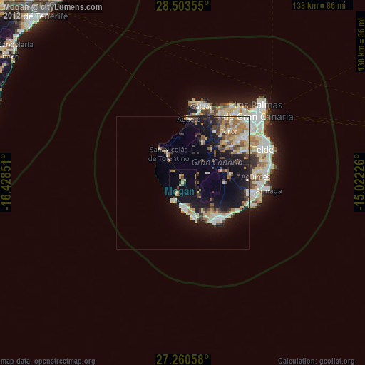
Mogán night lights from space
Night Light of Mogán (Canary Islands) from space (Spain) Src. Average luminocity for 10x10km area is 11.3144% and for 50x50km: 13.4787%.
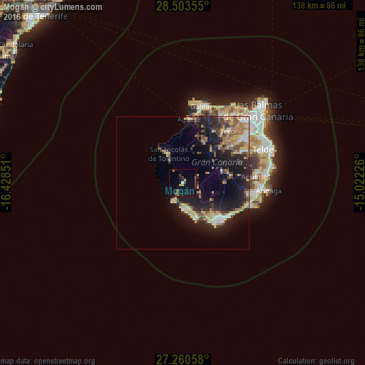
Analysis of Mogán night lights 2016
Square area 10x10 km:
 0.57%
0.57%90-99
0.19%80-89
0%70-79
2.84%60-69
1.89%50-59
0.19%40-49
3.03%30-39
2.65%20-29
1.33%10-19
11.93%0-9
75.38%Square area 50x50 km:
1.09%90-99
1.47%80-89
1.93%70-79
2.74%60-69
1.78%50-59
1.77%40-49
1.75%30-39
2.53%20-29
4.43%10-19
11.38%0-9
69.14%Clear (daylight) street map image can be seen on geolist.org.
Map coordinates:
28° 30' 12.8" North, 16° 25' 42.6" West
27° 53' 1.9" North, 15° 43' 31.4" West
27° 15' 38.1" North, 15° 1' 20.1" West
Some cities around Mogán sort by population:
• Santa Lucía
18.4 km =11.4 mi,  80°
80°
• San Bartolomé de Tirajana
15.6 km =9.7 mi,  73°
73°
• Maspalomas
19.4 km =12.1 mi,  135°
135°
• Playa del Ingles
20.2 km =12.6 mi,  134°
134°
• Puerto Rico
10.6 km =6.6 mi,  172°
172°
• San Nicolás
12.9 km =8 mi,  334°
334°
• Vega de San Mateo
23.4 km =14.5 mi,  53°
53°
• Agaete
24.2 km =15 mi,  5°
5°
2513798 (p: 21,690)
Sources (retrieved 2019-11-25):
» Earth at Night: Flat Maps 2012, 2016