Maspalomas night lights from space
Night Light of Maspalomas (Canary Islands) from space (Spain) Src. Average luminocity for 10x10km area is 50.1032% and for 50x50km: 12.8882%.
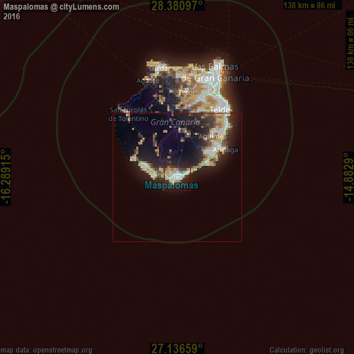
Analysis of Maspalomas night lights 2016
Square area 10x10 km:
 12.1%
12.1%90-99
10.71%80-89
7.94%70-79
7.14%60-69
3.77%50-59
2.38%40-49
1.79%30-39
9.72%20-29
16.87%10-19
24.8%0-9
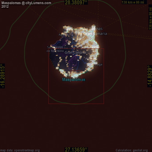
2.78%Square area 50x50 km:
1.45%90-99
1.68%80-89
2.24%70-79
2.08%60-69
1.1%50-59
1.15%40-49
1.66%30-39
2.49%20-29
4.2%10-19
11.25%0-9
70.69%Clear (daylight) street map image can be seen on geolist.org.
Map coordinates:
28° 22' 51.5" North, 16° 17' 20.9" West
27° 45' 38" North, 15° 35' 9.7" West
27° 8' 11.7" North, 14° 52' 58.4" West
Some cities around Maspalomas sort by population:
• Santa Lucía
17.4 km =10.8 mi,  14°
14°
• San Bartolomé de Tirajana
18.3 km =11.4 mi,  3°
3°
• Ingenio
23 km =14.3 mi,  40°
40°
• Agüimes
21.2 km =13.2 mi, 40°
• Mogán
19.4 km =12.1 mi,  315°
315°
• Playa del Ingles
0.8 km =0.5 mi,  120°
120°
• Vecindario
16.9 km =10.5 mi,  55°
55°
• Puerto Rico
12.7 km =7.9 mi,  284°
284°
2514042 (p: 33,000)
Sources (retrieved 2019-11-25):
» Earth at Night: Flat Maps 2012, 2016