Santa Lucía night lights from space
Night Light of Santa Lucía (Canary Islands) from space (Spain) Src. Average luminocity for 10x10km area is 17.3314% and for 50x50km: 26.2137%.
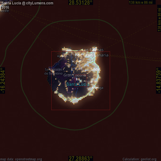
Analysis of Santa Lucía night lights 2016
Square area 10x10 km:
 0%
0%90-99
1.52%80-89
0.95%70-79
1.14%60-69
1.7%50-59
3.03%40-49
2.08%30-39
6.44%20-29
6.06%10-19
32.77%0-9
44.32%Square area 50x50 km:
3.62%90-99
4.36%80-89
4.3%70-79
4.92%60-69
2.78%50-59
2.92%40-49
3.35%30-39
4.16%20-29
6.67%10-19
14.8%0-9
48.12%Clear (daylight) street map image can be seen on geolist.org.
Map coordinates:
28° 31' 52.6" North, 16° 14' 37.8" West
27° 54' 42.3" North, 15° 32' 26.6" West
27° 17' 19.1" North, 14° 50' 15.3" West
Some cities around Santa Lucía sort by population:
• Telde
14.9 km =9.3 mi,  53°
53°
• San Bartolomé de Tirajana
3.5 km =2.2 mi,  294°
294°
• Ingenio
10.5 km =6.5 mi,  85°
85°
• Agüimes
9.3 km =5.8 mi, 94°
• Carrizal
13.3 km =8.3 mi, 90°
• Vecindario
11.9 km =7.4 mi,  127°
127°
• Valsequillo de Gran Canaria
9.3 km =5.8 mi,  27°
27°
• Vega de San Mateo
10.8 km =6.7 mi,  3°
3°
2511150 (p: 63,637)
Sources (retrieved 2019-11-25):
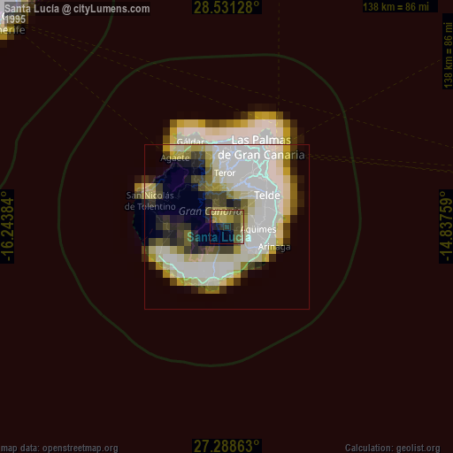
» NASA, Earths city lights 1995
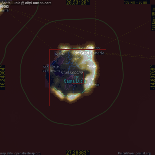
» NASA city lights 2003
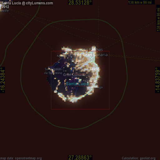
» Earth at Night: Flat Maps 2012, 2016