Miranda de Ebro night lights from space
Night Light of Miranda de Ebro (Castille and León) from space (Spain) Src. Average luminocity for 10x10km area is 28.5015% and for 50x50km: 7.4635%.
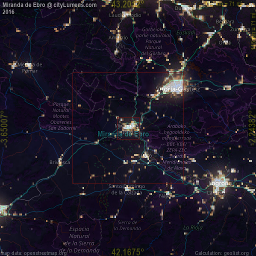
Analysis of Miranda de Ebro night lights 2016
Square area 10x10 km:
 4.24%
4.24%90-99
5.15%80-89
2.42%70-79
3.03%60-69
3.03%50-59
4.55%40-49
3.79%30-39
3.18%20-29
5.15%10-19
34.85%0-9
30.61%Square area 50x50 km:
1.39%90-99
1.25%80-89
0.79%70-79
0.59%60-69
0.71%50-59
0.91%40-49
0.85%30-39
1.18%20-29
1.96%10-19
4.22%0-9
86.14%Clear (daylight) street map image can be seen on geolist.org.
Map coordinates:
43° 12' 4.3" North, 3° 39' 0.3" West
42° 41' 11.4" North, 2° 56' 49" West
42° 10' 3" North, 2° 14' 37.8" West
Some cities around Miranda de Ebro sort by population:
• Gasteiz / Vitoria
28.8 km =17.9 mi,  50°
50°
• Logroño
47.5 km =29.5 mi,  120°
120°
• Haro
14.7 km =9.1 mi,  146°
146°
• Amurrio
40.6 km =25.2 mi,  353°
353°
• Nájera
34.8 km =21.6 mi, 149°
• Briviesca
34.3 km =21.3 mi,  243°
243°
• Santo Domingo de la Calzada
27.4 km =17 mi,  181°
181°
• Lardero
49.1 km =30.5 mi,  125°
125°
3116689 (p: 39,264)
Sources (retrieved 2019-11-25):
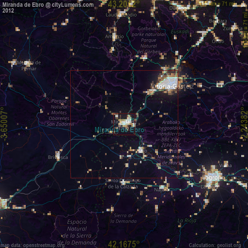
» Earth at Night: Flat Maps 2012, 2016