Logroño night lights from space
Night Light of Logroño (La Rioja) from space (Spain) Src. Average luminocity for 10x10km area is 56.973% and for 50x50km: 7.4789%.
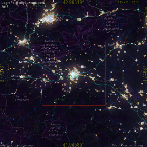
Analysis of Logroño night lights 2016
Square area 10x10 km:
 15.08%
90-99
17.46%80-89
6.03%70-79
3.81%60-69
3.97%50-59
5.08%40-49
3.97%30-39
7.62%20-29
22.86%10-19
13.97%0-9
0.16%Square area 50x50 km:
0.88%90-99
1.25%80-89
0.87%70-79
0.65%60-69
0.92%50-59
1.06%40-49
0.93%30-39
0.81%20-29
2.05%10-19
4.31%0-9
86.27%Clear (daylight) street map image can be seen on geolist.org.
Map coordinates:
42° 58' 59.5" North, 3° 9' 11.2" West
42° 28' 0" North, 2° 27' 0" West
41° 56' 45.1" North, 1° 44' 48.7" West
Some cities around Logroño sort by population:
• Calahorra
43.7 km =27.2 mi,  114°
114°
• Arnedo
39.1 km =24.3 mi,  132°
132°
• Estella-Lizarra
41.1 km =25.5 mi,  56°
56°
• Haro
34.8 km =21.6 mi,  290°
290°
• Nájera
23.5 km =14.6 mi,  256°
256°
• Santo Domingo de la Calzada
41.4 km =25.7 mi,  265°
265°
• Lardero
4.5 km =2.8 mi,  192°
192°
• San Adrián
44.8 km =27.8 mi, 109°
3118150 (p: 152,107)
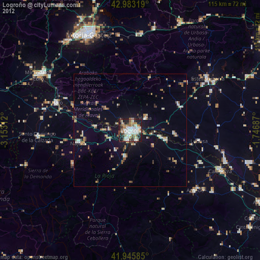
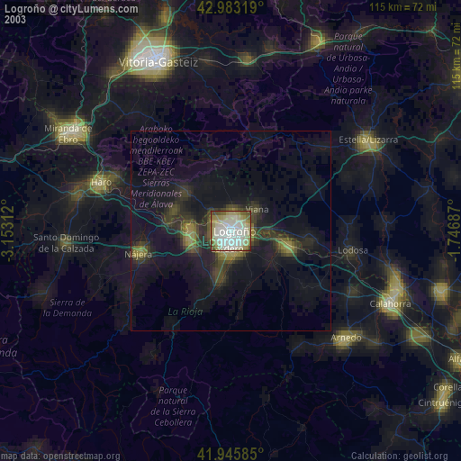
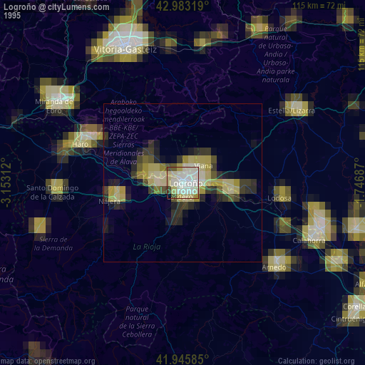
Sources (retrieved 2019-11-25):
» NASA, Earths city lights 1995
» NASA city lights 2003
» Earth at Night: Flat Maps 2012, 2016