La Gangosa Vistasol night lights from space
Night Light of La Gangosa Vistasol (Andalusia) from space (Spain) Src. Average luminocity for 10x10km area is 44.3776% and for 50x50km: 11.2161%.
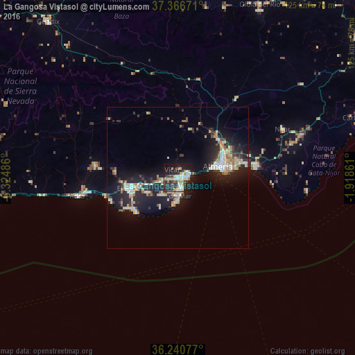
Analysis of La Gangosa Vistasol night lights 2016
Square area 10x10 km:
 6.99%
6.99%90-99
11.01%80-89
5.94%70-79
4.02%60-69
7.87%50-59
1.4%40-49
2.97%30-39
6.64%20-29
22.2%10-19
27.1%0-9
3.85%Square area 50x50 km:
1.44%90-99
2.26%80-89
1.18%70-79
1.01%60-69
1.77%50-59
0.77%40-49
0.84%30-39
1.62%20-29
4.17%10-19
10.67%0-9
74.28%Clear (daylight) street map image can be seen on geolist.org.
Map coordinates:
37° 22' 0.2" North, 3° 19' 29.5" West
36° 48' 20.9" North, 2° 37' 18.3" West
36° 14' 26.8" North, 1° 55' 7" West
Some cities around La Gangosa Vistasol sort by population:
• Almería
14.9 km =9.3 mi,  76°
76°
• El Ejido
17.5 km =10.9 mi,  259°
259°
• Roquetas de Mar
4.7 km =2.9 mi,  172°
172°
• Adra
36.1 km =22.4 mi, 259°
• Vícar
3.4 km =2.1 mi,  326°
326°
• Berja
29.5 km =18.3 mi,  278°
278°
• Huércal de Almería
18.6 km =11.6 mi,  61°
61°
• Aguadulce
4.5 km =2.8 mi, 78°
11169232 (p: 9,780)
Sources (retrieved 2019-11-25):
» Earth at Night: Flat Maps 2012, 2016