Huétor-Tájar night lights from space
Night Light of Huétor-Tájar (Andalusia) from space (Spain) Src. Average luminocity for 10x10km area is 9.2517% and for 50x50km: 3.5659%.
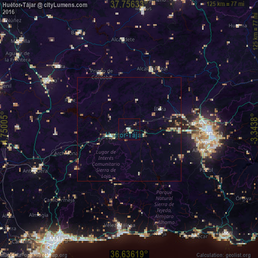
Analysis of Huétor-Tájar night lights 2016
Square area 10x10 km:
 0.51%
0.51%90-99
1.53%80-89
1.36%70-79
0.68%60-69
1.7%50-59
1.02%40-49
1.53%30-39
1.53%20-29
0.34%10-19
0%0-9
89.8%Square area 50x50 km:
0.1%90-99
0.46%80-89
0.56%70-79
0.47%60-69
0.57%50-59
0.54%40-49
0.62%30-39
0.59%20-29
0.52%10-19
1.32%0-9
94.24%Clear (daylight) street map image can be seen on geolist.org.
Map coordinates:
37° 45' 22.8" North, 4° 45' 0.2" West
37° 11' 54" North, 4° 2' 48.9" West
36° 38' 10.3" North, 3° 20' 37.7" West
Some cities around Huétor-Tájar sort by population:
• Priego de Córdoba
29.7 km =18.5 mi,  333°
333°
• Alcalá la Real
31.2 km =19.4 mi,  20°
20°
• Loja
9.8 km =6.1 mi,  250°
250°
• Santafé
29.1 km =18.1 mi,  92°
92°
• Pinos Puente
27 km =16.8 mi,  77°
77°
• Illora
17.7 km =11 mi,  55°
55°
• Montefrío
14.3 km =8.9 mi,  13°
13°
• Alhama de Granada
21.9 km =13.6 mi,  166°
166°
2516499 (p: 9,105)
Sources (retrieved 2019-11-25):
» Earth at Night: Flat Maps 2012, 2016