Fuente del Maestre night lights from space
Night Light of Fuente del Maestre (Extremadura) from space (Spain) Src. Average luminocity for 10x10km area is 4.1623% and for 50x50km: 3.2252%.
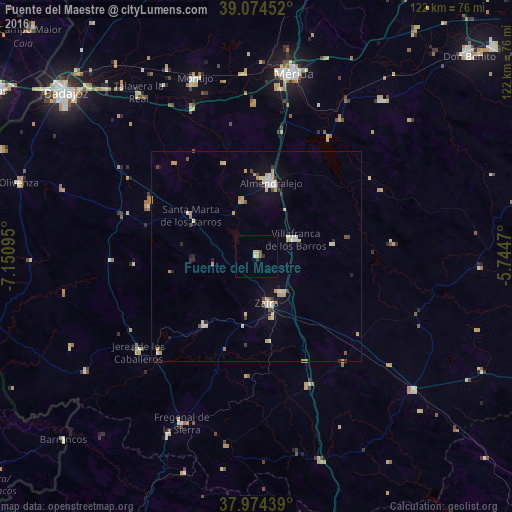
Analysis of Fuente del Maestre night lights 2016
Square area 10x10 km:
 0.16%
0.16%90-99
0.49%80-89
1.3%70-79
0.65%60-69
0%50-59
0.49%40-49
0.81%30-39
0.16%20-29
1.14%10-19
0%0-9
94.81%Square area 50x50 km:
0.35%90-99
0.4%80-89
0.75%70-79
0.65%60-69
0.17%50-59
0.13%40-49
0.29%30-39
0.34%20-29
0.42%10-19
1.17%0-9
95.32%Clear (daylight) street map image can be seen on geolist.org.
Map coordinates:
39° 4' 28.3" North, 7° 9' 3.4" West
38° 31' 35.6" North, 6° 26' 52.2" West
37° 58' 27.8" North, 5° 44' 40.9" West
Some cities around Fuente del Maestre sort by population:
• Almendralejo
17.8 km =11.1 mi,  11°
11°
• Zafra
11.6 km =7.2 mi,  166°
166°
• Villafranca de los Barros
10.3 km =6.4 mi,  67°
67°
• Jerez de los Caballeros
36.4 km =22.6 mi,  231°
231°
• Los Santos de Maimona
10.2 km =6.3 mi,  146°
146°
• Calamonte
40.6 km =25.2 mi, 7°
• Aceuchal
13.7 km =8.5 mi,  345°
345°
• Fregenal de la Sierra
43.6 km =27.1 mi,  204°
204°
2517547 (p: 6,748)
Sources (retrieved 2019-11-25):
» Earth at Night: Flat Maps 2012, 2016