Córdoba night lights from space
Night Light of Córdoba (Andalusia) from space (Spain) Src. Average luminocity for 10x10km area is 63.8685% and for 50x50km: 7.6535%.
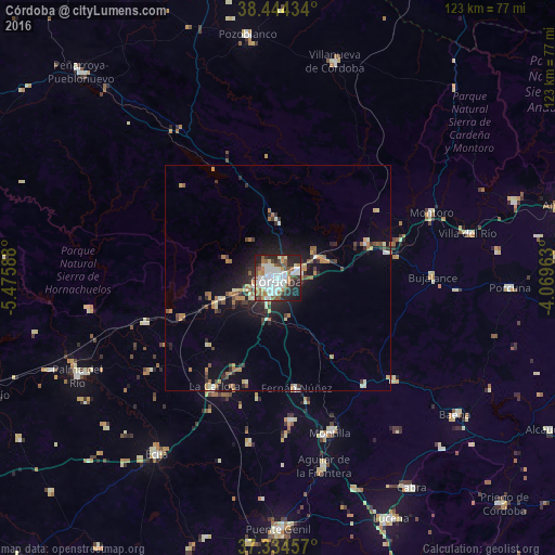
Analysis of Córdoba night lights 2016
Square area 10x10 km:
 23.21%
90-99
13.64%80-89
4.22%70-79
5.19%60-69
9.9%50-59
6.01%40-49
7.31%30-39
4.55%20-29
17.37%10-19
8.44%0-9
0.16%Square area 50x50 km:
1.14%90-99
1.02%80-89
0.65%70-79
0.93%60-69
1.46%50-59
0.86%40-49
0.89%30-39
1.03%20-29
2.3%10-19
4.85%0-9
84.85%Clear (daylight) street map image can be seen on geolist.org.
Map coordinates:
38° 26' 39.6" North, 5° 28' 33.2" West
37° 53' 29.6" North, 4° 46' 21.9" West
37° 20' 4.5" North, 4° 4' 10.7" West
Some cities around Córdoba sort by population:
• La Carlota
28 km =17.4 mi,  209°
209°
• Fuente Palmera
35.4 km =22 mi,  234°
234°
• Fernán-Núñez
24.9 km =15.5 mi,  170°
170°
• Castro del Río
34 km =21.1 mi,  130°
130°
• Bujalance
34.4 km =21.4 mi,  89°
89°
• Almodóvar del Río
23.5 km =14.6 mi,  247°
247°
• La Rambla
31.7 km =19.7 mi, 174°
• Posadas
31 km =19.3 mi, 251°
2519240 (p: 328,428)
Sources (retrieved 2019-11-25):
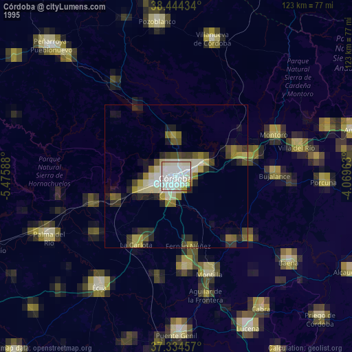
» NASA, Earths city lights 1995
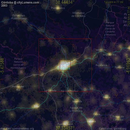
» NASA city lights 2003
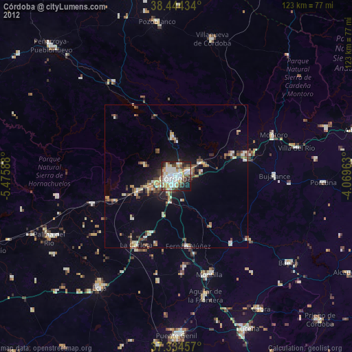
» Earth at Night: Flat Maps 2012, 2016