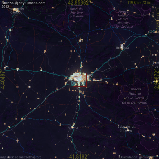
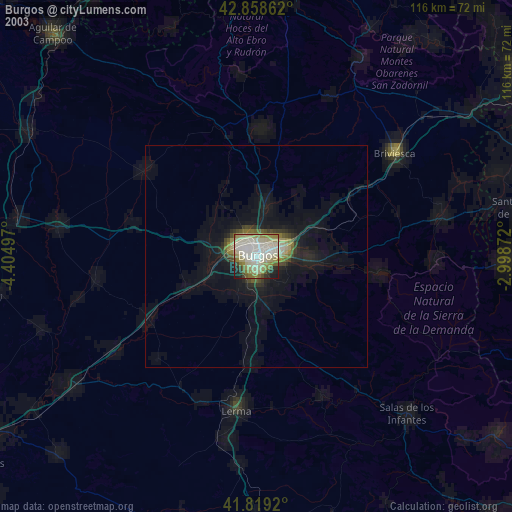
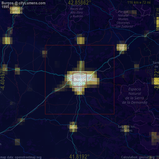
Burgos night lights from space
Night Light of Burgos (Castille and León) from space (Spain) Src. Average luminocity for 10x10km area is 61.8778% and for 50x50km: 4.9097%.
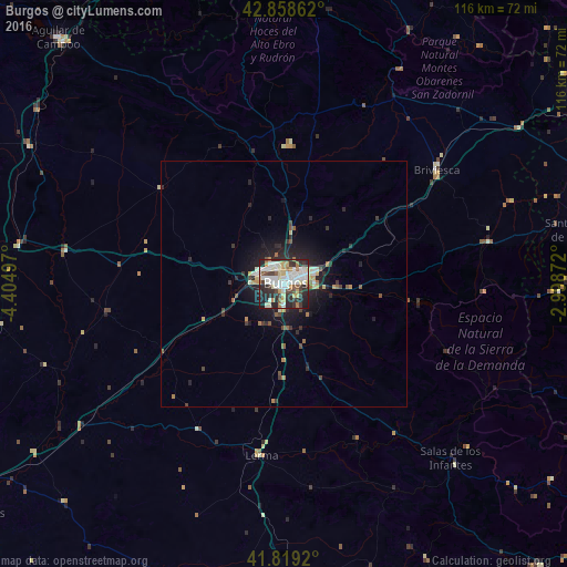
Analysis of Burgos night lights 2016
Square area 10x10 km:
 16.83%
90-99
16.98%80-89
8.41%70-79
5.71%60-69
4.6%50-59
3.65%40-49
5.4%30-39
9.52%20-29
22.7%10-19
6.19%0-9
0%Square area 50x50 km:
0.76%90-99
0.88%80-89
0.52%70-79
0.44%60-69
0.45%50-59
0.58%40-49
0.52%30-39
0.79%20-29
2.08%10-19
3.69%0-9
89.27%Clear (daylight) street map image can be seen on geolist.org.
Map coordinates:
42° 51' 31" North, 4° 24' 17.9" West
42° 20' 27.8" North, 3° 42' 6.6" West
41° 49' 9.1" North, 2° 59' 55.4" West
Some cities around Burgos sort by population:
• Gamonal
2.9 km =1.8 mi,  53°
53°
• Miranda de Ebro
72.8 km =45.2 mi,  58°
58°
• Aranda de Duero
74.6 km =46.4 mi,  179°
179°
• Haro
74.8 km =46.5 mi,  69°
69°
• Aguilar de Campoo
68 km =42.3 mi,  317°
317°
• Briviesca
38.8 km =24.1 mi, 53°
• Santo Domingo de la Calzada
62.4 km =38.8 mi,  79°
79°
• Medina de Pomar
67.7 km =42.1 mi,  14°
14°
3127461 (p: 178,966)
Sources (retrieved 2019-11-25):
» NASA, Earths city lights 1995
» NASA city lights 2003
» Earth at Night: Flat Maps 2012, 2016